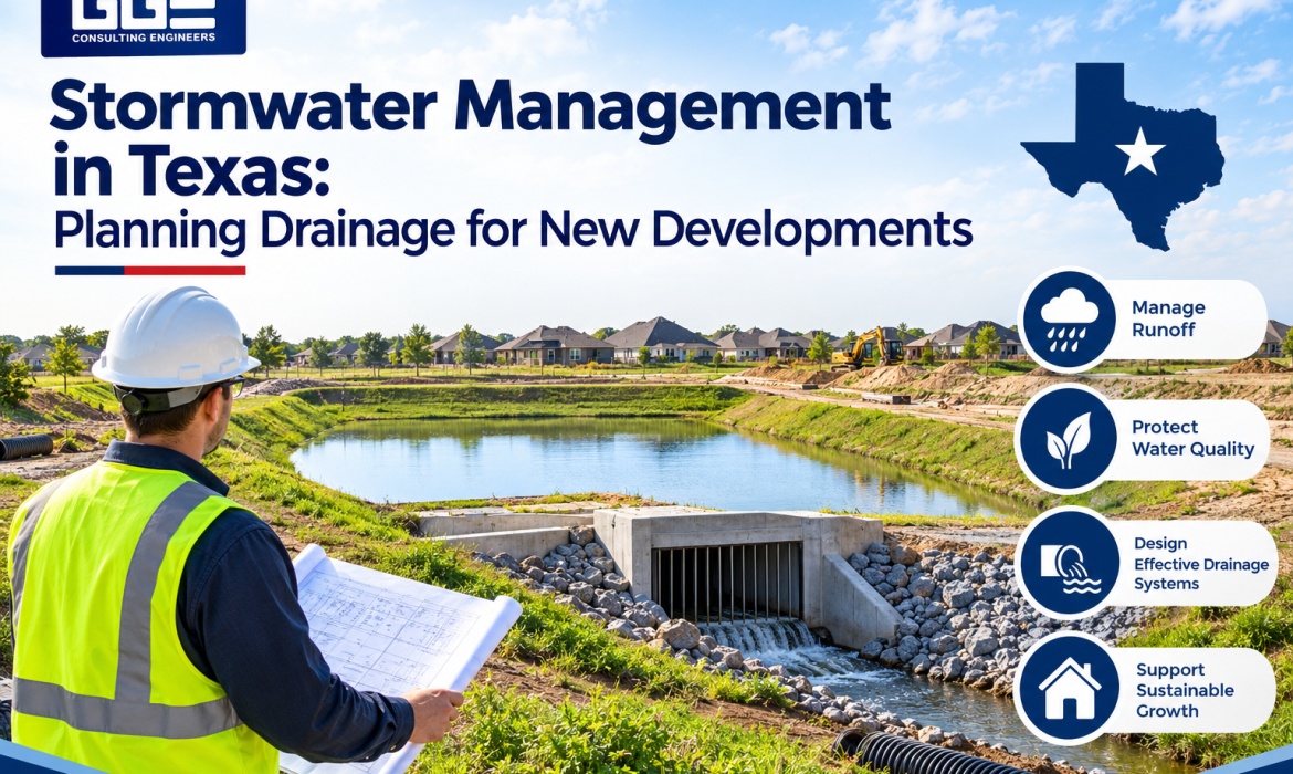
Stormwater planning is an essential part of preparing land for commercial construction in Texas. When rainwater flows across a development site, it can affect buildings, parking areas, access roads, nearby properties, and public drainage infrastructure. Without proper planning, runoff may collect in unwanted areas, contribute to erosion, or create drainage problems after construction.
For developers and property owners, understanding stormwater management in Texas helps identify drainage requirements before site work begins. A coordinated engineering approach considers existing land conditions, rainfall patterns, grading, drainage paths, and applicable local regulations.
GGE Consulting Engineers supports development projects through civil engineering, drainage design, land surveying, and floodplain-related services. These disciplines help project teams evaluate site conditions and prepare infrastructure plans that support safe, functional, and compliant development.
Understanding How Rainwater Affects a Development Site
Stormwater refers to rainwater that flows over land instead of soaking into the ground. Natural surfaces such as grass and soil can absorb some rainfall, while developed areas often contain roofs, concrete, asphalt, and other surfaces that limit infiltration.
As a result, commercial development can change how quickly and where water moves across a property. A drainage plan must account for these changes and identify suitable ways to collect, convey, store, and release runoff.
Stormwater planning commonly addresses:
- Runoff generated by buildings, parking areas, sidewalks, and driveways.
- Existing drainage channels, ditches, and low-lying areas.
- Changes in ground elevation caused by grading and earthwork.
- Connections to existing public or private drainage systems.
- Potential effects on neighboring properties and downstream areas.
Effective stormwater management in Texas considers both the proposed development and the surrounding watershed. This broader view helps engineers understand how a project may influence drainage conditions beyond its property boundaries.
Site Conditions That Shape Drainage Design
Before selecting drainage solutions, engineers need reliable information about the property. Existing terrain, soil conditions, drainage features, and nearby infrastructure all influence how runoff should be managed.
A site assessment helps establish the conditions that will guide the engineering design.
Existing Elevations and Surface Features
Topographic information helps engineers understand the direction and movement of surface water. Elevation changes can influence where runoff collects, how quickly it flows, and whether additional drainage infrastructure is necessary.
A professional survey can document:
- Existing ground elevations and contours.
- Drainage channels and natural flow paths.
- Roadways, structures, and paved surfaces.
- Utility features and other site improvements.
- Low areas that may collect stormwater.
GGE provides land surveying services that support development planning by documenting existing property conditions. Accurate survey information gives civil engineers a reliable starting point for grading and drainage design.
Existing Drainage Infrastructure
Nearby storm drains, culverts, roadside ditches, and channels may influence the drainage strategy for a new development. Engineers evaluate available infrastructure to determine whether it can accommodate the proposed runoff and whether improvements are required.
Connecting a new drainage system without understanding the capacity and condition of existing infrastructure can create problems for both the development and surrounding properties.
Engineering Elements Used to Control Runoff
A stormwater plan combines several design elements to manage runoff from the beginning of a rainfall event through its eventual discharge. The appropriate combination depends on site conditions, project requirements, and applicable drainage criteria.
Runoff and Watershed Evaluation
Hydrologic analysis estimates how much runoff a site may generate under selected rainfall conditions. Engineers review drainage areas, land cover, surface characteristics, and watershed conditions to understand how rainfall becomes surface flow.
This analysis helps determine the design requirements for drainage pipes, channels, detention facilities, and other stormwater infrastructure.
Grading and Drainage Flow Direction
Site grading establishes the elevations that guide surface water toward designated collection and conveyance points. Engineers coordinate grading with building pads, parking areas, sidewalks, access routes, and property boundaries.
A properly coordinated grading plan helps prevent water from collecting around structures or flowing into areas where it could interfere with site operations.
Storm Sewer Networks and Drainage Channels
Storm sewer systems collect and transport runoff through structures such as inlets, pipes, culverts, and outlets. Open channels and ditches may also be used where site conditions and design requirements support them.
The drainage system must be evaluated as a connected network. Pipe capacity, channel geometry, slope, outlet conditions, and downstream restrictions can all affect system performance.
Detention and Stormwater Storage
Detention facilities temporarily store stormwater and release it at a controlled rate. These systems can help manage peak runoff from developed areas and support compliance with local drainage requirements.
Common stormwater storage features include:
- Detention ponds.
- Underground detention systems.
- Surface storage areas.
- Engineered drainage basins.
The design must consider storage capacity, inflow, outlet controls, overflow routes, and maintenance access. The facility should also fit into the overall site layout without creating conflicts with buildings, utilities, or vehicle circulation.
Texas-Specific Factors That Influence Drainage Planning
Drainage design must respond to local rainfall conditions, terrain, watershed characteristics, and regulatory requirements. Texas includes a wide range of geographic conditions, so a drainage approach suitable for one location may not work for another.
In South Texas and the San Antonio region, development teams must consider intense rainfall events, existing drainage patterns, local floodplain conditions, and the requirements of the reviewing authority.
Local Drainage Criteria and Review Requirements
Municipalities and other authorities may establish criteria for drainage calculations, detention facilities, storm sewer systems, channel improvements, and development plan submissions.
The applicable requirements depend on the project’s location and jurisdiction. Engineers should identify the reviewing agencies early and confirm the design standards that apply before completing drainage plans.
This is particularly important for projects involving public infrastructure, subdivision improvements, or connections to existing municipal drainage systems.
Floodplain Conditions and Downstream Effects
A property located near a mapped floodplain may require additional investigation before development can proceed. Engineers evaluate available floodplain information, existing elevations, water surface conditions, and proposed site improvements.
A project that changes grading or affects floodwater movement may require additional hydraulic analysis and coordination with the relevant authorities.
For developers planning projects in the San Antonio area, stormwater drainage design in San Antonio should account for both site-level runoff and the relationship between the property and the surrounding drainage network.
Connecting Floodplain Studies With Development Planning
Stormwater drainage and floodplain engineering are closely related, particularly when a proposed project is located within or near a mapped flood hazard area.
Floodplain analysis helps determine how a development may affect flood elevations, water movement, and mapped flood boundaries. It can also identify whether additional engineering documentation or FEMA coordination is necessary.
Depending on the project, the process may involve:
- Reviewing applicable Flood Insurance Rate Maps.
- Establishing existing ground elevations through surveying.
- Evaluating watershed and hydraulic conditions.
- Modeling proposed changes to the site.
- Preparing technical documentation for regulatory review.
Projects that require map changes may involve a Conditional Letter of Map Revision (CLOMR) or Letter of Map Revision (LOMR). A CLOMR evaluates a proposed project before construction, while a LOMR documents an approved map revision based on completed conditions or qualifying changes.
GGE provides civil engineering services that include drainage design and FEMA floodplain analysis CLOMR LOMR in Texas. Coordinating these services with site development can help identify potential floodplain constraints before they affect the construction process.
Coordinating Drainage With Other Site Improvements
Stormwater systems should not be designed separately from the rest of the development. Drainage infrastructure interacts with grading, utilities, roadways, parking areas, building locations, and landscape features.
When these elements are planned independently, design conflicts can emerge during permitting or construction.
A coordinated site development plan considers:
| Development Element | Stormwater Planning Consideration |
| Building locations | Direct runoff away from building foundations and entrances |
| Parking areas | Establish suitable slopes and drainage collection points |
| Access roads | Maintain drainage paths without affecting vehicle movement |
| Underground utilities | Identify conflicts with storm sewer lines and structures |
| Landscaping | Coordinate planting areas with drainage and surface grading |
| Property boundaries | Evaluate runoff discharge and potential downstream impacts |
| Detention facilities | Provide suitable storage, outlet controls, and maintenance access |
Working with a qualified site development civil engineering firm helps bring these elements together in a coordinated design. It also supports communication between surveyors, engineers, architects, contractors, and reviewing agencies.
Common Drainage Planning Issues That Can Affect Development
Drainage problems often develop when important site conditions are overlooked during early planning. Addressing these issues before construction can help reduce design revisions and improve project coordination.
| Common Issue | Potential Consequence | Recommended Planning Approach |
| Incomplete topographic information | Incorrect grading or drainage assumptions | Obtain accurate survey information |
| Insufficient runoff evaluation | Drainage systems may not meet design requirements | Complete appropriate hydrologic analysis |
| Poor grading coordination | Water may collect near buildings or pavement | Coordinate grading with drainage plans |
| Unchecked downstream conditions | Runoff may affect adjacent properties or infrastructure | Evaluate discharge locations and receiving systems |
| Overlooked floodplain restrictions | Additional approvals or design changes may be required | Review floodplain information early |
| Utility and drainage conflicts | Construction changes and installation difficulties | Coordinate utility layouts with storm sewer design |
Early engineering involvement helps project teams identify these concerns while the site layout can still be adjusted.
Documents and Information Needed for a Stormwater Design
The information required for drainage design varies according to project size, location, and regulatory requirements. However, several documents commonly support the engineering process.
Developers may need to provide:
- Property boundary and topographic survey information.
- Proposed site layout and building locations.
- Existing and proposed grading information.
- Available utility and drainage records.
- Relevant floodplain maps and supporting studies.
- Applicable local drainage criteria.
- Previous engineering reports, when available.
The engineering team uses this information to evaluate existing conditions, establish design assumptions, and prepare the required drainage documentation.
Providing accurate information early can also improve coordination between the project owner, design professionals, and reviewing agencies.
Choosing an Engineering Team for Stormwater Planning
Selecting an engineering partner involves more than reviewing whether a firm can prepare drainage drawings. Developers should consider the team’s ability to understand local requirements, coordinate multiple design disciplines, and support the project through regulatory review.
Important considerations include:
- Relevant Texas experience: The team should understand regional drainage conditions and applicable development requirements.
- Hydrologic and hydraulic capabilities: Engineers should be able to evaluate runoff, drainage networks, channels, and floodplain conditions.
- Surveying coordination: Reliable existing-condition information supports accurate engineering decisions.
- Regulatory knowledge: Familiarity with local review processes can help organize complete and consistent submissions.
- Construction coordination: Drainage plans should be practical to build and coordinated with other site improvements.
GGE Consulting Engineers provides civil and structural engineering, land surveying, and construction-related services for development projects in Texas. Its integrated approach supports coordination between site information, engineering design, and construction requirements.
Conclusion: Make Drainage Part of the First Development Decision
Stormwater planning plays an important role in the long-term performance of commercial and public development projects. Proper evaluation of runoff, grading, drainage infrastructure, detention requirements, and floodplain conditions helps create a site that responds to local conditions and applicable engineering standards.
For developers, addressing drainage early can reduce design conflicts and help identify regulatory requirements before construction begins. Coordinating surveying, civil engineering, and floodplain analysis also gives the project team a clearer understanding of site conditions.
GGE Consulting Engineers provides engineering and surveying support for development projects across Texas, including drainage design, stormwater analysis, and floodplain-related services. Contact us to discuss your development requirements and determine how coordinated engineering services can support your project’s planning and design.
Frequently Asked Questions About Stormwater Planning in Texas
Why is stormwater planning necessary for commercial development in Texas?
Stormwater planning helps control runoff from roofs, parking areas, roads, and other developed surfaces. It also helps address drainage requirements, reduce erosion concerns, and protect nearby properties and infrastructure.
What information is needed before preparing a drainage plan?
Engineers generally need property survey data, existing elevations, proposed site layouts, grading information, drainage records, and relevant floodplain information. Additional documents may be required depending on the project and local review criteria.
What is the purpose of a stormwater detention pond?
A detention pond temporarily stores runoff and releases it through a controlled outlet. It is designed to help manage peak discharge and meet applicable drainage requirements for a development.
When might a Texas development require a CLOMR or LOMR?
A CLOMR may be required when a proposed project could affect FEMA-mapped floodplain conditions. A LOMR documents an approved revision to the flood map. The specific requirements depend on the proposed work and applicable FEMA and local criteria.
How does a civil engineer support stormwater management?
A civil engineer evaluates site conditions, calculates runoff, designs drainage infrastructure, coordinates grading, and prepares engineering documents for review. The engineer may also support floodplain analysis and coordination during construction.