Floodplain requirements can significantly affect the planning, design, and approval of a development project. When a property is located in or near a mapped floodplain, developers need to consider more than the building itself. Site elevations, drainage patterns, grading, access, utilities, floodplain boundaries, and applicable development requirements can all influence the project.
Obtaining a floodplain permit in Texas can involve technical documentation and coordination that should be considered early. When floodplain conditions are discovered late in the design process, developers may face revisions to site layouts, grading plans, drainage systems, or other engineering documents.
GGE Consulting Engineers supports Texas development projects through civil engineering, land surveying, structural engineering, and construction-related services. Its integrated approach can help developers coordinate site information and engineering requirements before a project moves into construction.
Why Floodplain Permits Matter for Developers
Floodplain permits and related approvals are intended to ensure that development in flood-prone areas is properly evaluated and designed. Requirements can vary depending on the property’s location, floodplain designation, proposed improvements, and applicable jurisdictional requirements.
A floodplain permit should not be treated as a final administrative step. It can affect fundamental decisions about development.
For example, floodplain conditions may influence:
- Building placement
- Site grading
- Drainage design
- Finished elevations
- Parking areas
- Roads and driveways
- Utility infrastructure
- Stormwater management
- Construction planning
- Required engineering documentation
Understanding these considerations early gives developers an opportunity to address potential constraints while the project still has design flexibility.
Mistake 1: Waiting Too Long to Review Floodplain Conditions
One of the most common mistakes is waiting until the site design is nearly complete before reviewing floodplain conditions.
A developer may first focus on the building footprint, parking layout, access, and other site improvements. Later, the project team may discover that floodplain conditions affect some of those decisions.
This can result in redesign and additional coordination.
Why Early Review Is Important
Floodplain conditions should ideally be reviewed during property due diligence or preliminary site planning.
Early review can help answer questions such as:
- Is the property affected by a mapped floodplain?
- Which portions of the site may be affected?
- What existing elevation information is available?
- Are there drainage channels or other water features?
- Could proposed grading affect drainage?
- What engineering analysis may be necessary?
- What approvals should be considered?
Addressing these questions before detailed design can make the development process more predictable.
Mistake 2: Relying Only on Floodplain Maps
Floodplain mapping is an important source of information, but developers should not assume that a general map provides all the information needed for site design.
Actual site conditions can vary. Ground elevations, drainage features, channels, structures, and surrounding development can all affect how water behaves on a property.
A current survey can provide the detailed site information needed for engineering evaluation.
GGE Consulting Engineers provides land surveying services that document property boundaries, elevations, drainage features, structures, utilities, and other existing conditions relevant to development planning.
Why Survey Information Matters
Accurate elevation information is particularly important for floodplain-related projects. Engineers need reliable existing-condition information when evaluating grading, drainage, and proposed improvements.
Without current survey information, a project team may make important design decisions based on incomplete or outdated conditions.
Mistake 3: Using an Outdated or Incomplete Survey
A survey is not simply a document to attach to a permit package. It is one of the foundations of the engineering design.
Outdated survey information may not reflect current site conditions, new improvements, drainage changes, utility modifications, or other physical changes.
For floodplain development, incomplete elevation information can create additional uncertainty.
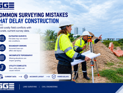
A current topographic survey can help document:
- Existing ground elevations
- Drainage patterns
- Buildings and structures
- Roads and paved areas
- Utility features
- Property boundaries
- Easements and rights-of-way
- Other relevant site features
GGE integrates land surveying with civil engineering so that survey information can directly support site design and development planning.
Mistake 4: Designing Grading Without Considering Drainage
Grading and drainage are closely connected.
A proposed building, parking area, driveway, or other improvement can change how stormwater moves across a property. If grading is designed without considering existing drainage patterns and floodplain conditions, the project may require revisions.
This is one reason floodplain development in Texas should be evaluated as an integrated engineering issue rather than a separate permitting task.
Coordinating Grading and Drainage
A coordinated design should consider:
- Existing ground elevations
- Proposed finished elevations
- Drainage flow paths
- Stormwater collection
- Site access
- Building pads
- Parking areas
- Surrounding properties
- Existing drainage infrastructure
GGE’s civil engineering services include site grading, stormwater drainage, floodplain management, and related infrastructure planning, making these disciplines easier to coordinate within a development project.
Mistake 5: Ignoring the Relationship Between the Building and Site
Developers sometimes focus heavily on the building footprint while treating the surrounding site as a separate issue.
In floodplain areas, this approach can create problems because the building, grading, drainage, parking, utilities, and access routes need to work together.
Changing the building location can affect parking. Changing parking elevations can affect drainage. Changing grading can affect access and stormwater flow.
A coordinated design considers these relationships from the beginning.
Mistake 6: Failing to Evaluate Drainage Conditions
Drainage conditions should be reviewed before the final site layout is established.
Engineers may need to understand how water currently moves through the property and how proposed improvements could change those conditions.
Depending on the project, evaluation may consider:
- Existing drainage channels
- Surface runoff
- Stormwater infrastructure
- Site topography
- Proposed grading
- Adjacent properties
- Roads and drainage crossings
- Proposed buildings and paved areas
This information can help the engineering team develop a site plan that accounts for existing drainage characteristics.
Mistake 7: Treating Floodplain Engineering as a Separate Task
Floodplain engineering should be coordinated with broader civil engineering rather than treated as an isolated technical exercise.
For example, a floodplain condition may influence a building location. That building location can then affect grading, drainage, utilities, parking, and access.
Floodplain engineering services can help connect these considerations and provide a more complete understanding of how proposed improvements interact with the site.
GGE Consulting Engineers provides civil engineering services that include floodplain management, stormwater drainage, grading, utilities, roads, and site development.
Mistake 8: Not Understanding Permit Requirements Early
Another common mistake is assuming that all development approvals can be addressed at the same time through a standard site plan review.
Floodplain-related projects can have additional requirements depending on the jurisdiction and proposed development.
Developers should identify applicable requirements during the early planning stage.
What Early Permit Review Can Identify
Early review can help determine:
- Required engineering documentation
- Survey requirements
- Drainage considerations
- Floodplain-related technical information
- Site plan requirements
- Potential review comments
- Additional coordination needs
This does not guarantee a particular approval outcome, but it gives the project team an opportunity to address known requirements before construction documents are finalized.
Mistake 9: Poor Coordination Between Surveying and Engineering
When surveying and engineering are handled without adequate coordination, inconsistencies can develop between existing-condition information and design documents.
This can affect grading, drainage, property boundaries, utilities, and other site improvements.
An integrated approach allows survey information to move directly into civil engineering design.
For developers, this can create a more consistent workflow from site investigation through engineering documentation and construction support.
Mistake 10: Ignoring Utility and Access Requirements
Floodplain considerations do not stop at the building and drainage system.
Roads, driveways, water systems, wastewater infrastructure, and other utilities should be evaluated as part of the complete site plan.
Coordinating Site Infrastructure
A coordinated site design should consider how:
- Roads relate to proposed grades
- Driveways connect with access points
- Utilities connect to proposed buildings
- Stormwater systems interact with grading
- Parking areas drain appropriately
- Infrastructure fits within available development areas
GGE’s civil engineering practice includes roads, stormwater systems, water and wastewater utilities, site grading, floodplain management, and subdivision infrastructure.
Mistake 11: Making Major Design Decisions Before Engineering Review
Developers often have a preliminary vision for how a property should be developed. However, floodplain and site conditions may affect whether that concept can be implemented as originally planned.
Engineering review should occur before major site decisions become difficult to change.
A preliminary engineering evaluation can help developers understand:
- Site constraints
- Drainage conditions
- Floodplain considerations
- Available development areas
- Infrastructure requirements
- Survey needs
- Potential permitting issues
This information can help the project team refine the development concept before investing heavily in detailed plans.
Mistake 12: Failing to Coordinate Construction With Approved Plans
Obtaining a permit is not necessarily the end of floodplain-related engineering coordination.
During construction, site conditions may differ from the assumptions made during design. Contractors may also have questions about grading, drainage, utilities, or other improvements.
Construction administration and engineering support can help keep field implementation aligned with approved plans.
GGE provides construction management services that include construction coordination, contractor submittal review, site observations, and support through project closeout.
How Developers Can Avoid Floodplain Permit Mistakes
A proactive approach can reduce common problems and improve coordination.
Developers should consider the following steps:
- Review floodplain conditions during property due diligence.
- Obtain current land surveying information.
- Evaluate existing elevations and drainage features.
- Coordinate floodplain considerations with civil engineering.
- Review grading and drainage together.
- Identify applicable permit requirements early.
- Coordinate utilities and access with the site plan.
- Review engineering documents before submission.
- Address agency comments systematically.
- Maintain engineering support through construction when appropriate.
The exact process will depend on the project, site, and applicable jurisdiction.
What Information Should Developers Prepare?
Having relevant project information available early can help an engineering team evaluate the site more effectively.
Useful information may include:
|
Project Information |
Why It Is Useful |
|
Property survey |
Establishes boundaries and existing conditions |
|
Topographic information |
Shows existing elevations and terrain |
|
Floodplain information |
Helps identify potential flood-related constraints |
|
Preliminary site plan |
Shows proposed development |
|
Building layout |
Helps evaluate the relationship between structures and site conditions |
|
Drainage information |
Supports stormwater evaluation |
|
Utility records |
Helps coordinate existing and proposed infrastructure |
|
Development objectives |
Helps engineers understand the intended project |
Providing this information during the early planning stage can help identify missing information before detailed engineering begins.
Why Choose GGE Consulting Engineers for Floodplain-Related Projects?
GGE Consulting Engineers is a Texas-based civil and structural engineering and land surveying firm serving governmental, commercial, and residential clients. The firm combines civil engineering, structural engineering, land surveying, and construction management capabilities.
For floodplain-related development, this multidisciplinary approach can be valuable because several project elements need to be coordinated.
GGE’s civil engineering capabilities include floodplain management, stormwater drainage, site grading, utilities, roads, and subdivision infrastructure. Its surveying team provides the existing-condition information required to support civil design.
This integrated model allows developers to address surveying and engineering requirements as part of a coordinated development process.
When Should You Contact a Floodplain Engineering Team?
The best time to involve an engineering team is before major site design decisions are finalized.
Early involvement is particularly useful when:
- The property is located in or near a floodplain.
- The project involves significant grading.
- New commercial or residential buildings are proposed.
- Drainage patterns may change.
- Roads or parking areas are being developed.
- New utility infrastructure is required.
- Floodplain-related approvals may apply.
- The project involves subdivision or larger land development.
Early engineering review gives developers more flexibility to respond to site conditions and regulatory requirements.
Conclusion
Avoiding floodplain permit mistakes starts with early planning. Developers should not wait until the final stages of design to evaluate floodplain conditions, survey information, drainage, grading, utilities, access, and applicable approvals.
A floodplain permit in Texas should be considered part of the broader development process rather than an isolated paperwork requirement. Accurate surveying, coordinated civil engineering, and early review can help identify potential constraints before they result in major design revisions.
GGE Consulting Engineers supports Texas property owners and developers through integrated land surveying, civil engineering, structural engineering, floodplain management, and construction-related services. This multidisciplinary approach helps connect existing site conditions with practical development solutions.
If you are planning development in a flood-prone area and need professional guidance with surveying, civil design, or floodplain-related engineering, Contact Us to discuss your project with GGE Consulting Engineers.
Frequently Asked Questions
What is a floodplain permit in Texas?
A floodplain permit is an approval associated with development or construction in an area subject to applicable floodplain requirements. Specific requirements depend on the property’s location, project type, and governing jurisdiction.
What is the most common floodplain permit mistake?
One common mistake is waiting too long to evaluate floodplain conditions. Early review can help identify survey, grading, drainage, engineering, and permitting considerations before detailed plans are completed.
Is a land survey required for floodplain development?
Survey requirements vary by project, but accurate elevation and existing-condition information are important for floodplain-related engineering. A current survey can support grading, drainage, and site development design.
Why are floodplain engineering services important?
Floodplain engineering services help evaluate how proposed development interacts with floodplain conditions, elevations, drainage patterns, grading, and other site improvements.
Can GGE Consulting Engineers help with floodplain development?
Yes. GGE Consulting Engineers provides civil engineering, land surveying, floodplain management, structural engineering, and construction-related services that can support Texas development projects.