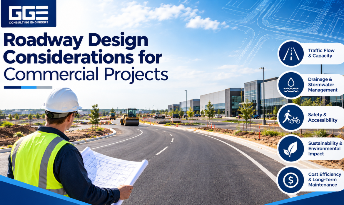
Commercial development requires more than planning buildings, parking areas, and utilities. Roadways are essential infrastructure that connects a property to public transportation networks and allows customers, employees, delivery vehicles, and emergency services to reach the site safely. Their layout also affects traffic circulation, drainage, pedestrian movement, and the overall functionality of a development.
For developers in Texas, roadway planning must account for site conditions, projected traffic, vehicle types, local design standards, and connections to existing streets. A road that appears suitable on a preliminary site plan may require adjustments after engineers evaluate turning movements, pavement requirements, drainage patterns, and access restrictions.
Roadway engineering in Texas brings these considerations together through technical evaluation, design coordination, and regulatory review. GGE Consulting Engineers provides civil engineering and roadway design services for private developments and public infrastructure projects. Understanding the main design considerations helps project owners make informed decisions before construction begins.
1. Understanding the Purpose of Roadway Design in Commercial Projects
Roadway design establishes how vehicles and pedestrians move through and around a development. It covers the arrangement, dimensions, alignment, pavement structure, and supporting infrastructure needed to make transportation routes functional.
Commercial properties may require internal access roads, driveway connections, service routes, loading areas, and improvements to nearby public streets. Each component should support the intended site use without creating unnecessary conflicts.
A coordinated roadway plan considers several objectives:
- Safe access: Provide suitable entry and exit points for vehicles.
- Traffic circulation: Organize vehicle movement within the property.
- Operational functionality: Accommodate customers, employees, deliveries, and service vehicles.
- Pedestrian connectivity: Provide appropriate routes between parking areas, buildings, and sidewalks.
- Infrastructure coordination: Integrate roadway improvements with utilities, grading, and drainage.
- Regulatory compliance: Address applicable municipal, county, and state requirements.
Roadway design should therefore be considered during early site planning rather than treated as a separate task after the building layout has been established.
2. Evaluating Site Conditions Before Roadway Design
The existing property conditions influence where roads can be placed and how they should be designed. Engineers begin by reviewing available site information to identify physical constraints, infrastructure connections, and potential design challenges.
Topographic and Boundary Information
Topographic surveys provide information about existing elevations, contours, drainage features, roadways, and other site improvements. Boundary information establishes the property limits and helps identify easements and rights-of-way that may affect roadway placement.
This information supports decisions about road alignment, grading, pavement elevations, and connections to existing streets.
For commercial projects, accurate survey information is particularly important when a proposed roadway must connect to an existing public road or cross areas with significant elevation changes.
GGE Consulting Engineers provides land surveying services that support civil engineering and site development. Coordinating survey information with roadway design helps establish a consistent understanding of existing property conditions.
Traffic Patterns and Vehicle Requirements
Roadways should be designed around the types and volumes of vehicles expected to use them. A retail property may experience frequent passenger vehicle movements, while a warehouse or industrial facility may require access for large trucks and delivery vehicles.
Engineers consider:
- Expected daily and peak-hour traffic.
- Passenger cars, service vehicles, and delivery trucks.
- Emergency vehicle access.
- Vehicle turning movements.
- Internal circulation and potential congestion points.
- Future changes in site use or traffic demand.
Understanding these patterns helps determine the appropriate roadway configuration and identifies areas where additional turning space or circulation improvements may be necessary.
Existing Infrastructure and Site Constraints
Nearby roads, drainage systems, utility lines, structures, and adjacent properties can influence the proposed roadway layout. Engineers review these conditions to determine whether the planned improvements can be constructed without creating conflicts.
For example, an existing utility corridor may limit the available space for a new road, while an established drainage channel may affect roadway elevation and alignment.
Identifying these conditions early gives the design team an opportunity to evaluate alternatives before the site plan becomes difficult to change.
3. Planning Safe and Efficient Site Access
Access design determines how vehicles enter and leave a commercial property. Poorly located driveways or inadequate connections can create traffic conflicts, reduce visibility, and interfere with nearby roadway operations.
Driveway Location and Spacing
Driveway placement should consider the type of adjoining road, traffic conditions, property frontage, nearby intersections, and applicable access requirements.
Too many access points can introduce unnecessary conflict areas. On the other hand, insufficient access may create circulation difficulties within the development.
Engineers evaluate driveway locations in relation to:
- Existing intersections and nearby driveways.
- Available sight distance.
- Traffic volumes and turning movements.
- Property boundaries and frontage conditions.
- Pedestrian routes and parking entrances.
- Applicable access management standards.
Where a development connects to a state highway, additional coordination with the Texas Department of Transportation (TxDOT) may be necessary. The responsible authority and permitting process depend on the roadway jurisdiction and project location.
Turning Movements and Sight Distance
Vehicles must be able to enter, exit, and turn within the development without creating unsafe conflicts. Engineers evaluate turning paths for the vehicles expected to use the property.
Large trucks may require wider turning areas than passenger vehicles. Delivery routes, loading zones, and emergency access should also be considered when planning internal road connections.
Sight distance is another important factor. Drivers need adequate visibility when approaching intersections, entering driveways, or making turning movements. Site grading, landscaping, signs, and nearby structures should not create avoidable visibility restrictions.
Connections to Public Roads
A commercial development may require improvements where its access road meets an existing public street. These connections must account for roadway geometry, pavement transitions, drainage, and traffic operations.
Depending on the location and scope, the project may require access permits, traffic-related documentation, or coordination with the local roadway authority.
4. Important Roadway Geometry and Alignment Considerations
Roadway geometry determines the physical arrangement of the road. Alignment, lane dimensions, grades, curves, and cross-sections influence how vehicles move and how the roadway fits into the surrounding property.
Horizontal and Vertical Alignment
Horizontal alignment describes the roadway’s path when viewed from above. It includes straight sections, curves, and transitions. Vertical alignment describes changes in roadway elevation through grades and vertical curves.
Both must be coordinated with the existing terrain and proposed site improvements.
Engineers evaluate:
- Curve geometry and vehicle operating requirements.
- Roadway grades and elevation transitions.
- Sight distance along curves and grades.
- Connections to existing roads.
- Drainage direction and finished surface elevations.
- Available right-of-way and property constraints.
A suitable alignment should support vehicle movement while avoiding unnecessary earthwork and conflicts with other infrastructure.
Lane Widths, Grades, and Cross-Sections
Roadway cross-sections show the arrangement of travel lanes and supporting features across the road. Depending on the project, these may include shoulders, curbs, sidewalks, medians, and drainage elements.
The appropriate dimensions depend on roadway classification, traffic demand, design vehicles, local criteria, and the project’s intended function.
Roadway grades also influence vehicle operation and surface drainage. Excessive or poorly coordinated slopes may affect accessibility, vehicle movement, and water collection.
Intersections and Internal Circulation
Intersections should be designed to support clear and predictable vehicle movements. Their layout must account for turning paths, visibility, traffic volumes, and pedestrian crossings where applicable.
Internal circulation is equally important. A commercial property should allow vehicles to move between entrances, parking areas, loading spaces, and exits without unnecessary conflicts.
A well-organized circulation plan can help prevent bottlenecks near building entrances and reduce interference between customer traffic and service vehicles.
5. Pavement Design for Commercial Traffic
Pavement design determines whether a roadway can support the expected traffic loads over its intended service life. Commercial roads may experience different loading conditions depending on the property type and vehicle mix.
Passenger vehicles, delivery trucks, garbage collection vehicles, and emergency vehicles can place different demands on pavement structures.
Traffic Loading and Pavement Selection
Engineers evaluate anticipated traffic and loading conditions when selecting an appropriate pavement section. The design may involve flexible pavement, rigid pavement, or another suitable system based on project requirements.
Important considerations include:
- Expected traffic volume and vehicle classification.
- Frequency of heavy vehicle movements.
- Turning and stopping areas.
- Loading zones and service routes.
- Applicable local pavement design criteria.
Areas exposed to repeated truck movements may require different pavement considerations from lightly traveled passenger vehicle routes.
Subgrade Conditions
The soil beneath a roadway supports the pavement structure. Its strength and condition influence pavement performance and the type of preparation needed before construction.
Geotechnical information, when required, can help engineers understand soil characteristics and identify conditions that may affect pavement support.
Weak or inconsistent subgrade conditions may require additional preparation or stabilization measures. These decisions should be based on project-specific evaluations rather than assumptions about the property.
Construction Quality and Long-Term Performance
Even a well-designed pavement section depends on appropriate construction practices. Subgrade preparation, material quality, compaction, drainage, and construction inspection all influence the finished roadway.
Construction documentation should clearly communicate the required materials, dimensions, and installation details. Appropriate quality control helps confirm that the work follows the approved design.
6. Integrating Drainage With Roadway Design
Roadways change the way rainwater moves across a property. Pavement creates relatively impermeable surfaces, while grading determines where runoff travels and collects.
Drainage should therefore be considered alongside roadway geometry and pavement elevations.
A coordinated design may include:
- Roadway cross-slopes that direct surface water toward collection points.
- Inlets and storm sewer systems to collect runoff.
- Ditches or channels where appropriate.
- Culverts at drainage crossings.
- Detention facilities when required by drainage criteria.
- Suitable discharge routes and outlet protection.
GGE Consulting Engineers includes roadway and stormwater drainage design within its civil engineering services. Coordinating these elements as part of the overall site plan helps address drainage requirements alongside access and circulation.
7. Pedestrian Safety, Accessibility, and Site Connectivity
Commercial roadways serve more than vehicles. Customers, employees, visitors, and service personnel may need to walk between parking areas, building entrances, sidewalks, and nearby public facilities.
Pedestrian routes should be considered early so that they can be integrated with roadway geometry and grading.
Design considerations may include:
- Sidewalk locations and connections.
- Accessible routes between parking and building entrances.
- Curb ramps and pedestrian crossings.
- Clear pedestrian visibility at driveways and intersections.
- Appropriate slopes and transitions.
- Separation between pedestrian and vehicle movements where needed.
Applicable accessibility requirements should be confirmed for the project and jurisdiction. In Texas, the design team should also consider relevant state and local accessibility review requirements.
Pedestrian facilities should connect logically to the rest of the property. A sidewalk that ends before reaching a building entrance or forces users through a vehicle loading area does not provide an effective route.
8. Coordinating Roadways With Utilities and Other Site Improvements
Roadway design is closely connected to other civil engineering disciplines. Water lines, wastewater pipes, storm sewer systems, electrical infrastructure, and other underground services may occupy the same corridors as proposed roads.
If these systems are designed independently, conflicts may emerge during plan review or construction.
Coordination should address:
- Utility locations and required separation.
- Pipe crossings beneath roadways.
- Easements and rights-of-way.
- Drainage structures and roadway elevations.
- Building access and foundation locations.
- Landscaping and streetscape features.
- Construction sequencing and maintenance access.
The following table illustrates how roadway design interacts with other development components.
| Project Component | Roadway Design Consideration |
| Water and wastewater | Coordinate utility alignments, crossings, and access |
| Stormwater drainage | Establish suitable grades, inlets, and discharge paths |
| Building locations | Maintain functional access and circulation |
| Parking areas | Connect aisles and driveways to the roadway layout |
| Pedestrian facilities | Provide accessible routes and safe crossings |
| Landscaping | Maintain visibility and avoid conflicts with infrastructure |
| Emergency access | Accommodate required vehicle routes and turning movements |
A coordinated approach is particularly important for subdivision infrastructure civil engineering, where roads, utilities, drainage, and individual property connections must work together across a larger development.
9. Texas Roadway Standards, Permits, and Approvals
Roadway design requirements depend on the project’s location, roadway ownership, classification, and reviewing authority. A commercial driveway connecting to a city street may follow different procedures from an access connection to a state highway.
Texas roadway projects may involve local municipalities, counties, TxDOT, utility providers, and other agencies depending on the scope.
The TxDOT Roadway Design Manual provides guidance on roadway design considerations, including traffic characteristics, access management, safety, geometry, and drainage. Local authorities may also have their own standards and review requirements.
Before finalizing a roadway design, project teams should establish:
- Which agency has jurisdiction over the adjoining roadway.
- Which design standards and details apply.
- Whether an access or driveway permit is required.
- What traffic or drainage documentation must be submitted.
- Whether right-of-way or easement coordination is necessary.
- What plan review and construction acceptance steps apply.
Working with a civil engineer in Austin TX who understands local review procedures can help identify the applicable requirements early.
10. Roadway Design Requirements for Different Commercial Developments
The roadway layout should reflect the purpose and operating conditions of the development. Different property types create different traffic patterns and infrastructure needs.
| Development Type | Key Roadway Considerations |
| Retail centers | Customer access, parking circulation, pedestrian crossings, and delivery routes |
| Office developments | Employee traffic, visitor access, parking connections, and accessible routes |
| Industrial facilities | Heavy vehicle turning movements, loading access, pavement loading, and truck circulation |
| Warehouses and distribution centers | Large vehicle access, loading areas, turning space, and internal circulation |
| Mixed-use developments | Multiple traffic types, pedestrian connectivity, and coordinated access |
| Residential subdivisions | Street layout, intersection spacing, emergency access, and connections to utilities |
A project-specific design should account for expected traffic and the way each part of the development will operate.
11. Common Roadway Design Challenges and How to Address Them
Roadway problems often arise when important requirements are overlooked during early site planning. Identifying these issues before construction can help reduce revisions and improve coordination.
| Common Challenge | Possible Impact | Planning Approach |
| Inadequate site access | Traffic conflicts and difficult vehicle entry | Evaluate access location and turning movements early |
| Poor roadway alignment | Reduced visibility or inefficient circulation | Review geometry against site conditions and design criteria |
| Insufficient pavement evaluation | Premature pavement distress | Assess traffic loading and subgrade conditions |
| Incomplete drainage coordination | Ponding, erosion, or pavement damage | Integrate grading and drainage with roadway plans |
| Utility conflicts | Construction changes and installation delays | Coordinate underground infrastructure before final design |
| Limited pedestrian planning | Unsafe or disconnected walking routes | Include accessible pedestrian connections in the site layout |
| Unclear permit requirements | Additional review cycles | Identify the responsible authorities and submission criteria early |
These issues demonstrate why roadway design should be part of a coordinated civil engineering process rather than an isolated drawing exercise.
12. The Role of Civil Engineers in Commercial Roadway Projects
Civil engineers evaluate how a roadway will function within the development and connect to surrounding infrastructure. Their work may include site assessment, alignment design, grading, pavement design, drainage coordination, and preparation of engineering documents.
For commercial developers, a civil engineering team can help with:
- Reviewing existing site conditions and survey information.
- Evaluating access and circulation requirements.
- Developing roadway geometry and cross-sections.
- Coordinating pavement and drainage design.
- Integrating utilities and other site improvements.
- Preparing plans for applicable agency reviews.
- Supporting construction through technical coordination.
GGE Consulting Engineers provides civil engineering, land surveying, and related infrastructure services for public and private projects across Texas. Its roadway design capabilities include horizontal and vertical alignment, pavement structural design, traffic control plans, ADA ramp design, and roadway cross-sections.
Conclusion: Plan Roadway Infrastructure Around the Entire Development
Roadway design is a key part of successful commercial development. Access points, traffic circulation, alignment, pavement structure, drainage, pedestrian routes, and utility coordination all influence how a property functions after construction.
Considering these factors early helps developers identify site constraints, understand applicable review requirements, and coordinate roadway improvements with other infrastructure. The design should be based on actual site conditions, expected traffic, vehicle requirements, and the standards established by the responsible authorities.
GGE Consulting Engineers provides roadway and civil engineering support for commercial, residential, and public infrastructure projects in Texas. From site evaluation and roadway alignment to pavement design and drainage coordination, an integrated engineering approach helps address the technical requirements of development. Contact us to discuss your roadway design needs and the engineering considerations for your upcoming project.
Frequently Asked Questions
What does roadway engineering involve in a commercial development?
Roadway engineering involves planning and designing roads, driveways, intersections, pavement sections, and related infrastructure. It also considers traffic movement, drainage, pedestrian access, and connections to existing streets.
Why is traffic analysis important before designing a commercial roadway?
Traffic analysis helps engineers understand expected vehicle volumes, turning movements, and the types of vehicles using the property. This information supports decisions about access locations, roadway dimensions, and internal circulation.
What factors affect pavement design for commercial roads?
Pavement design depends on expected traffic, heavy vehicle loading, soil and subgrade conditions, drainage, material properties, and applicable design criteria. Different areas of a commercial site may require different pavement considerations.
Does a commercial development need approval for a new roadway connection?
Approval requirements depend on the roadway jurisdiction and project location. Connections to public streets or state highways may require access permits, engineering plans, and coordination with the responsible authority.
How does a civil engineer support commercial roadway design?
A civil engineer evaluates site conditions, develops roadway alignments, coordinates grading and drainage, considers pavement requirements, and prepares engineering documents. The engineer may also assist with agency reviews and construction coordination.