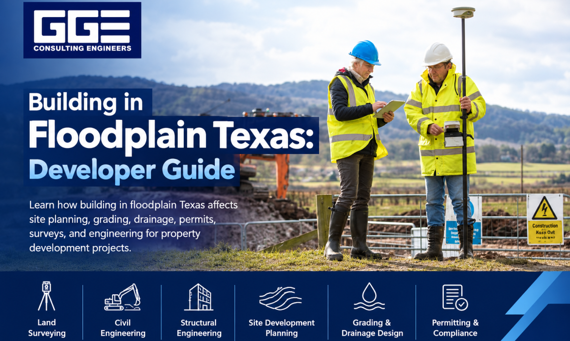
Developing property in a floodplain requires more planning than a typical construction project. Flood conditions can affect where a building can be located, how the property is graded, how stormwater is managed, and what engineering and permitting considerations must be addressed before construction.
For developers and property owners, building in floodplain Texas areas does not necessarily mean that development is impossible. However, the project needs to account for existing elevations, floodplain boundaries, drainage patterns, access, utilities, and applicable local development requirements.
GGE Consulting Engineers supports Texas property development projects through land surveying, civil engineering, structural engineering, and construction-related services. Early engineering evaluation can help development teams understand site conditions and incorporate floodplain considerations into the project from the beginning.
What Does Building in a Floodplain Mean?
Building in floodplain Texas refers to developing or constructing property located within an area that may be subject to flooding. Floodplain boundaries and classifications are generally identified through flood hazard mapping and related technical information.
When a property is located within or near a mapped floodplain, the development team needs to understand how those conditions could affect the proposed project.
The impact can vary considerably from one property to another. Two properties located in the same general flood-prone area may have different elevations, drainage patterns, existing improvements, and development constraints.
For this reason, developers should evaluate the actual property rather than relying only on a general flood zone designation.
Why Floodplain Conditions Matter
Floodplain conditions can influence:
- Building locations
- Finished elevations
- Site grading
- Stormwater drainage
- Parking areas
- Roads and driveways
- Utility infrastructure
- Access routes
- Construction planning
- Development permits
Understanding these considerations early can help developers make better decisions about the feasibility and layout of a project.
Can You Build on Floodplain Property in Texas?
Development may be possible on floodplain property, but the requirements depend on the site’s location, flood conditions, proposed improvements, and applicable regulations.
Before construction begins, developers should determine how the property’s floodplain conditions affect the proposed building and surrounding site improvements.
A preliminary engineering review can help identify potential constraints before detailed plans are completed.
For example, a proposed building may need to be positioned differently because of existing elevations or drainage conditions. Similarly, grading and stormwater improvements may need to be coordinated to avoid creating unintended impacts.
The important point is that floodplain development should be evaluated as part of the overall site design rather than treated as a separate issue at the end of the project.
Step 1: Review the Property Before Designing the Project
The first step is to understand the property and its existing conditions.
Developers should review the available property information, floodplain mapping, existing surveys, topography, drainage features, structures, access points, utilities, and other relevant site characteristics.
This preliminary review can help determine whether additional surveying or engineering analysis is needed.
Review Floodplain Information
Floodplain mapping provides important information about potential flood hazards affecting a property. However, map information should be considered alongside current site conditions.
The project team should identify the portions of the property that may be affected and determine how the proposed development relates to those areas.
Review Existing Site Conditions
A current land survey can provide valuable information about:
- Property boundaries
- Existing ground elevations
- Structures
- Roads
- Drainage features
- Utilities
- Easements
- Rights-of-way
- Other physical improvements
This information provides a foundation for civil engineering and site development planning.
Step 2: Obtain an Accurate Land Survey
Surveying is one of the most important early steps for floodplain-related development.
Accurate elevations are particularly important because floodplain conditions are closely related to the vertical relationship between existing ground conditions and flood-related elevations.
A survey can also help identify existing drainage features and physical conditions that may not be apparent from aerial imagery or general mapping.
GGE Consulting Engineers provides land surveying services in Texas developers can use to establish existing conditions before moving into detailed engineering design.
A coordinated survey and engineering process can help ensure that site design decisions are based on reliable information.
Step 3: Evaluate Floodplain and Drainage Conditions
Once the existing site information is available, the development team can evaluate how floodplain and drainage conditions relate to the proposed project.
This evaluation may consider:
- Existing ground elevations
- Floodplain boundaries
- Drainage channels
- Surface water flow
- Existing stormwater infrastructure
- Proposed grading
- Proposed building locations
- Roads and access
- Surrounding development
The goal is to understand how the proposed improvements may interact with existing water movement.
Why Drainage Matters
Development can change the way stormwater moves across a property.
Buildings, pavement, grading, and other improvements can alter runoff patterns. Therefore, drainage should be considered during the initial site layout rather than added after the building footprint has already been established.
This is where site development engineering becomes particularly important. Civil engineers can coordinate grading, drainage, utilities, access, and other infrastructure with the property’s existing conditions.
Step 4: Plan the Building Location Carefully
Building placement is an important consideration when developing floodplain property.
The proposed building should be evaluated in relation to existing site elevations, drainage patterns, access, utilities, and applicable floodplain requirements.
Moving the building footprint may affect other parts of the site. For example, changing the building location can influence parking, driveways, utility connections, grading, and stormwater infrastructure.
This is why the building should not be evaluated independently from the rest of the development.
Consider Finished Elevations
Finished elevations are an important part of floodplain-related development planning. The relationship between the proposed building elevation and surrounding site conditions can influence drainage and access.
Engineers can coordinate proposed building areas with grading and drainage plans to create a more cohesive site design.
Step 5: Develop a Coordinated Grading Plan
Grading determines how the surface of a property will be shaped after development.
For floodplain projects, grading should be carefully coordinated with existing drainage conditions and the proposed improvements.
A grading plan may address:
- Building pads
- Parking areas
- Driveways
- Sidewalks
- Roads
- Drainage features
- Stormwater infrastructure
- Property transitions
The objective is to establish appropriate site elevations while considering how stormwater will move through the property.
Poor coordination between grading and drainage can create problems during construction or after the project is completed.
Step 6: Design the Stormwater Drainage System
Stormwater management is another important consideration for development in flood-prone areas.
Civil engineers may evaluate existing runoff conditions and determine how proposed development could affect stormwater movement.
Depending on the project, drainage design may involve:
- Storm drainage systems
- Inlets
- Conveyance systems
- Detention or other stormwater facilities
- Drainage channels
- Grading improvements
- Connections to existing infrastructure
The appropriate design depends on the site’s characteristics and project requirements.
A well-coordinated drainage design should work with the overall grading plan and proposed site improvements.
Step 7: Evaluate Roads, Access, and Utilities
Floodplain conditions can also affect infrastructure beyond the building itself.
Roads and driveways should be coordinated with site elevations and drainage. Access routes need to function with the proposed grading and surrounding improvements.
Utilities should also be considered during early design.
Water, sanitary sewer, stormwater, electrical, and other infrastructure may need to be coordinated with grading, building locations, and existing site conditions.
Infrastructure Coordination
A development plan should consider how each infrastructure component connects to the others.
For example:
- Building elevations can affect utility connections.
- Grading can affect stormwater drainage.
- Drainage can affect road and parking elevations.
- Road elevations can influence site access.
- Utility locations can affect grading and construction sequencing.
This integrated approach is an important part of effective site development engineering.
Step 8: Understand Floodplain and Development Permits
Before construction begins, developers should identify the approvals required for the specific project.
Requirements can vary depending on the jurisdiction, property location, floodplain conditions, proposed improvements, and project type.
Floodplain considerations may require specific engineering documentation or coordination as part of the development approval process.
Why Early Permit Review Matters
Identifying requirements early can reduce the possibility of major design changes later.
If floodplain requirements are discovered after the building layout, grading, and drainage plans are already complete, revisions may affect several parts of the project.
Early coordination allows engineering considerations to be incorporated into the design from the beginning.
Common Mistakes When Building in a Floodplain
Floodplain development can become more complicated when important site conditions are overlooked.
Common mistakes include:
- Starting design without current survey information
- Relying only on general floodplain maps
- Ignoring existing drainage patterns
- Designing grading without considering stormwater movement
- Selecting a building location before evaluating site constraints
- Delaying engineering review
- Failing to coordinate utilities with grading
- Treating floodplain requirements as a final-stage issue
- Not coordinating surveying and civil engineering
- Making site layout decisions without considering surrounding drainage
These issues can often be reduced through early planning and professional engineering involvement.
How Site Development Engineering Supports Floodplain Projects
Site development engineering provides the technical framework for turning property information into a workable development plan.
Civil engineers can evaluate existing conditions and coordinate the major components of a site, including grading, drainage, utilities, access, and other infrastructure.
For floodplain properties, this coordination is especially important because changes to one part of the site can affect another.
Grading and Drainage Coordination
The grading plan and drainage design should work together. Engineers can evaluate how proposed elevations affect runoff and how stormwater infrastructure can be incorporated into the site.
Utility Planning
Utilities can be integrated with the proposed building locations, roads, grading, and other improvements.
Site Access
Access routes can be coordinated with site elevations, drainage, parking, and surrounding infrastructure.
Construction Documentation
Detailed engineering plans provide contractors with information needed to construct the proposed improvements according to the approved design.
How GGE Consulting Engineers Supports Floodplain Development
GGE Consulting Engineers provides engineering and surveying services for property owners, developers, and other project stakeholders in Texas.
Floodplain-related projects often benefit from coordination between surveying and engineering because accurate existing-condition information is necessary for effective site design.
GGE’s services can support different stages of development, including:
- Land surveying
- Civil engineering
- Structural engineering
- Site development planning
- Grading and drainage design
- Construction-related coordination
The goal is to develop practical engineering solutions that reflect the property’s existing conditions and the developer’s objectives.
For projects requiring site development engineering, integrating surveying and civil design early can help create a more coordinated development process.
When Should You Start Planning a Floodplain Project?
Floodplain considerations should be reviewed as early as possible.
Ideally, developers should begin evaluating floodplain conditions during property due diligence or preliminary feasibility planning.
Early evaluation can help answer questions such as:
- Is the property affected by floodplain conditions?
- What portions of the property may be constrained?
- Are current elevation and survey records available?
- What drainage features exist?
- How might the proposed development affect runoff?
- Where should buildings and access improvements be located?
- What engineering analysis may be required?
- What development approvals should be considered?
These questions can help developers establish a more informed project strategy before committing to detailed design.
A Practical Checklist for Building on Floodplain Property
Before advancing a project, developers can use the following checklist:
- Review available floodplain information.
- Obtain a current land survey.
- Verify existing site elevations.
- Identify drainage features and flow paths.
- Evaluate proposed building locations.
- Coordinate grading and drainage.
- Review road and access requirements.
- Coordinate utility infrastructure.
- Identify applicable development and floodplain approvals.
- Complete required engineering analysis.
- Prepare detailed civil engineering plans.
- Coordinate construction requirements with the approved design.
Using a structured process can help the development team identify important issues before construction begins.
Why Early Engineering Involvement Matters
One of the biggest advantages of early engineering involvement is the opportunity to address constraints before they become expensive design problems.
When floodplain conditions are considered during initial planning, the development team can evaluate alternative building locations, grading concepts, drainage strategies, and infrastructure layouts.
This provides greater flexibility than discovering significant constraints after construction documents have been completed.
For developers, early coordination also helps connect surveying, civil engineering, structural considerations, permitting, and construction planning.
Conclusion
Building in floodplain Texas properties requires careful evaluation of floodplain conditions, site elevations, drainage patterns, building locations, grading, utilities, access, and development requirements. While floodplain conditions can create additional challenges, early planning and coordinated engineering can help developers make informed decisions about how a property can be developed.
GGE Consulting Engineers supports Texas development projects through integrated land surveying, civil engineering, structural engineering, and construction-related services. By evaluating floodplain considerations early, development teams can better coordinate their site design with existing conditions and project objectives.
If you are planning a project on property affected by floodplain conditions and need professional engineering support, Contact Us to discuss your project with GGE Consulting Engineers.
Frequently Asked Questions
Can you build on floodplain property in Texas?
Development may be possible depending on the property’s floodplain conditions, location, proposed improvements, and applicable requirements. Early engineering evaluation can help identify project constraints.
Why is a survey important for floodplain development?
A current survey provides accurate property boundaries, elevations, drainage features, structures, and other existing conditions needed for effective site and engineering design.
What does site development engineering include?
Site development engineering can include grading, drainage, utilities, access, stormwater infrastructure, and other civil improvements needed to prepare property for development.
Should drainage be considered before building design?
Yes. Drainage and grading should be considered during early site planning because the building location and other improvements can affect how stormwater moves across the property.
Can GGE Consulting Engineers help with floodplain projects?
Yes. GGE Consulting Engineers provides land surveying, civil engineering, structural engineering, and construction-related services that can support Texas property development projects affected by floodplain conditions.