
A topographic survey Texas commercial developers can use provides detailed information about existing elevations, terrain, drainage features, structures, and other physical conditions on a property. This information helps engineers understand the site before detailed design begins.
For commercial projects, GGE Consulting Engineers uses surveying and engineering capabilities to support the transition from existing site conditions to planned development. Understanding what a topographic survey includes can help property owners and developers determine what information their project needs before design and construction.
What Is a Topographic Survey?
A topographic survey is a detailed measurement and mapping process used to document the physical characteristics of a property. Unlike a boundary survey, which primarily focuses on property limits, a topographic survey focuses on the site’s existing physical conditions.
Depending on the project scope, the survey may document elevations, contours, slopes, drainage features, structures, pavement, curbs, fences, visible utilities, trees, and other relevant improvements.
The resulting survey provides a representation of existing site conditions that can be used by civil engineers, architects, planners, developers, and other project professionals.
For commercial development, this information can become an important base for grading plans, drainage design, utility layouts, access planning, parking design, and other engineering work.
Why Are Topographic Surveys Important for Commercial Development?
Commercial development projects often involve multiple improvements on a single property. Buildings, parking areas, driveways, utilities, stormwater facilities, landscaping, and access points all need to work together within the site’s existing physical conditions.
Without reliable elevation and site information, design teams may have to make assumptions about existing conditions.
A topographic survey in Texas development teams obtain before design can help identify conditions that may influence the layout or feasibility of the project.
For example, a site that appears relatively flat from an aerial image may actually contain gradual elevation changes. Those changes can affect drainage patterns, finished-floor elevations, parking grades, accessible routes, and stormwater management.
A topographic survey helps turn those conditions into usable engineering information.
What Does a Topographic Survey Include?
The exact scope depends on the property and intended use. A commercial survey may include a combination of horizontal and vertical information.
| Survey Information | Why It Matters for Commercial Development |
| Existing elevations | Supports grading and site design |
| Contours | Shows changes in terrain |
| Drainage features | Helps evaluate stormwater movement |
| Buildings and structures | Establishes existing improvements |
| Pavement and curbs | Supports access and parking design |
| Visible utility features | Helps coordinate utility planning |
| Trees and vegetation | Supports site planning and design |
| Fences and walls | Documents existing site features |
| Roadways and access points | Supports circulation planning |
| Spot elevations | Provides detailed elevation information at important locations |
Not every project requires every feature listed above. The survey scope should be developed around the project’s actual design requirements.
How Does a Topographic Survey Support Site Development Engineering?
Site development engineering depends heavily on accurate information about existing site conditions.
Civil engineers use survey data to evaluate how a proposed development can fit on the property while addressing grading, drainage, utilities, access, and other infrastructure requirements.
Grading and Drainage Design
Existing elevations help engineers determine how water currently moves across a property and how proposed improvements could change that movement.
The survey can provide elevation information needed to develop proposed grades and drainage systems.
For example, if a proposed commercial building is located lower than surrounding pavement, the engineering team may need to consider finished-floor elevations, grading, drainage inlets, swales, or other stormwater measures.
Building Placement
Topographic information can influence where a building is positioned.
A steep slope, drainage feature, or significant elevation change may make one portion of the site less suitable for development. Understanding those conditions early allows the project team to consider them before the site plan is finalized.
Parking and Driveways
Commercial parking areas need appropriate grades for vehicle circulation, drainage, accessibility, and connection to adjacent roads.
Topographic information helps engineers understand existing elevations and develop proposed grades that work with the surrounding site.
Utility Planning
Water, sanitary sewer, stormwater, and other utility systems often depend on elevation.
Accurate survey information helps engineers evaluate how proposed utilities can connect with existing infrastructure and how grades may affect gravity-flow systems.
This makes the survey an important part of coordinated site development engineering.
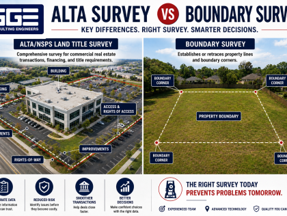
Topographic Survey vs. Boundary Survey
A common misconception is that one survey automatically provides all information needed for commercial development.
A boundary survey and topographic survey serve different purposes.
| Feature | Boundary Survey | Topographic Survey |
| Property boundaries | Primary focus | May be incorporated into broader scope |
| Property corners | Typically addressed | May be included |
| Elevations | Generally not the primary purpose | Primary component |
| Contours | Not normally the main purpose | Commonly included |
| Drainage features | Limited or scope-dependent | Commonly documented |
| Existing structures | Scope-dependent | Often documented |
| Civil site design | Limited information | Frequently supports design |
| Property acquisition | Common application | May support due diligence |
| Grading and drainage | Limited | Important application |
For many commercial development projects, both boundary and topographic information may be needed.
The boundary survey establishes the legal framework of the property, while the topographic survey provides physical information about what exists within that framework.
When Should a Commercial Developer Order a Topographic Survey?
A topographic survey should generally be considered before detailed civil engineering design begins.
Obtaining survey information early allows the engineering team to identify site conditions before the proposed layout becomes too advanced.
A survey may be useful during:
- Initial development feasibility
- Site planning
- Civil engineering design
- Grading and drainage planning
- Utility design
- Access and parking design
- Permitting preparation
- Construction planning
For larger commercial projects, early surveying can also help the team identify constraints that may affect the development concept.
How a Topographic Survey Supports Commercial Site Planning
Commercial sites often have competing design requirements. The building needs to fit within setbacks, parking needs to meet applicable requirements, driveways must connect appropriately, and stormwater must be managed within the available space.
Existing terrain can influence all of these decisions.
A topographic survey Texas developers commission at the beginning of the process can give the design team a clearer understanding of the physical site before detailed engineering begins.
Consider a commercial parcel that slopes toward an existing roadway. The development team may need to determine how the building, parking lot, driveway, and drainage infrastructure can be arranged without creating grading or stormwater problems.
The survey does not make the design decisions. Instead, it provides the existing-condition information that allows the design team to make those decisions based on measurable site conditions.
What Is the Role of Topographic Surveys in Civil Engineering?
A topographic survey is often one of the first datasets used by civil engineers when developing a site plan.
A civil engineering firm in Texas developers work with may use survey information to develop plans for:
- Site grading
- Stormwater management
- Drainage systems
- Utility infrastructure
- Parking and access
- Roadway connections
- Erosion and sediment controls
- Other site improvements
GGE Consulting Engineers provides surveying services alongside civil and structural engineering capabilities. This can be relevant when survey information needs to transition directly into engineering design.
The quality and completeness of the survey data can influence the quality of the resulting engineering plans.
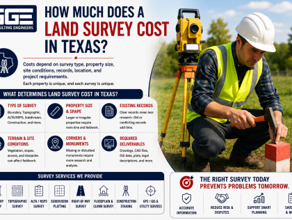
What Can Affect the Scope of a Topographic Survey?
Not every property requires the same survey scope.
Several conditions can influence the amount of information that needs to be collected.
Property Size
Larger properties generally require more field coverage and may contain more varied terrain and existing features.
Terrain
Steep slopes, wooded areas, dense vegetation, drainage channels, and other difficult conditions can affect fieldwork.
Existing Improvements
Commercial properties may contain buildings, parking areas, retaining walls, fences, utilities, pavement, landscaping, and other features that need to be documented.
Development Complexity
A simple commercial building may require less information than a large mixed-use development with extensive roads, utilities, parking, and stormwater infrastructure.
Engineering Requirements
The civil engineer may identify specific information needed for grading, drainage, utilities, access, or other design tasks.
This is why the survey scope should be discussed with the engineering team before fieldwork begins.
Best Practices for Ordering a Topographic Survey
The best results usually come from defining the survey requirements before the survey crew arrives on site.
Coordinate With the Civil Engineer
Discuss the proposed development with the engineer before finalizing the survey scope. The engineering team can identify the site features and elevations needed for design.
Provide Existing Documents
Provide available deeds, plats, previous surveys, site plans, title information, utility information, and other relevant documents.
Identify the Intended Use
Tell the surveyor whether the survey will support commercial development, redevelopment, grading, drainage, utility design, permitting, or another purpose.
Confirm Deliverables
Ask whether the final package will include the information your design team needs. Depending on the project, this could include CAD files, digital terrain data, survey drawings, or other digital formats.
Consider Existing Utilities
Visible utility features can be important for site planning. However, survey information should not automatically be treated as a complete underground utility investigation unless that work is specifically included in the scope.
Common Topographic Survey Mistakes
Using Aerial Images as a Replacement
Aerial imagery can provide useful context, but it does not replace field-collected survey information required for detailed engineering.
Ordering an Incomplete Survey
A survey that does not capture required drainage features, elevations, utilities, or improvements may require additional work later.
Starting Engineering Too Early
Beginning detailed design before obtaining reliable existing-condition information can lead to revisions when actual site conditions are discovered.
Not Coordinating With the Engineer
If the surveyor does not know how the data will be used, important information may be left outside the original scope.
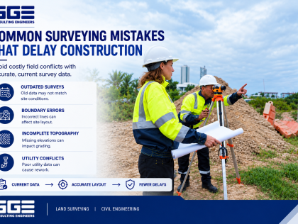
Using Outdated Survey Data
Existing conditions may change. New pavement, structures, landscaping, utility improvements, or other site changes can make older survey information unsuitable for a new project.
How to Choose a Civil Engineering Firm Texas Developers Can Work With
When selecting a civil engineering firm in Texas property developers can rely on, consider more than the firm’s ability to prepare drawings.
Look for experience with the type of development being planned and an understanding of how surveying, engineering, permitting, drainage, utilities, access, and construction fit together.
It is also useful to confirm how the engineering team works with survey information.
GGE Consulting Engineers provides civil engineering and land surveying services, allowing survey information to support related development design tasks. Its published services include topographic surveys, boundary surveys, ALTA/NSPS surveys, subdivision platting, floodplain and CLOMR surveying, construction staking, and other surveying capabilities.
For a development project, this type of coordination can help reduce gaps between field information and engineering design.
Conclusion
A topographic survey Texas commercial developers obtain before design can provide the existing-condition information needed to understand terrain, elevations, drainage, structures, and other site features. That information can support better planning and more informed site development engineering decisions.
GGE Consulting Engineers provides surveying and engineering services that can support commercial development from existing-condition documentation through civil design. If your project requires a topographic survey, the appropriate scope should be based on the property’s conditions and the information required by the engineering team.
When evaluating a civil engineering firm Texas developers can work with, consider how effectively surveying information can be coordinated with the broader development process.Contact us to discuss your project and determine the appropriate topographic survey scope.
Frequently Asked Questions
What is a topographic survey used for?
A topographic survey documents elevations, contours, drainage features, structures, and other existing site conditions. It supports grading, drainage, utility, parking, and site design.
Is a topographic survey required for commercial development?
Requirements vary by project and jurisdiction. However, commercial developments commonly need topographic information for grading, drainage, utilities, access, and building placement.
What is the difference between a topographic and boundary survey?
A boundary survey establishes or retraces property lines and corners. A topographic survey documents physical conditions such as elevations, slopes, contours, and drainage features.
Does a topographic survey locate underground utilities?
Not usually. It may document visible utility features, while underground utility locating generally requires separate specialized services.
When should a topographic survey be completed?
It is generally best completed before detailed site design and civil engineering begins. This gives engineers current information about existing site conditions.
How does a topographic survey support site development engineering?
Survey data provides the existing-condition information needed for grading, drainage, utilities, parking, and access design. It helps engineers develop plans based on actual site conditions.