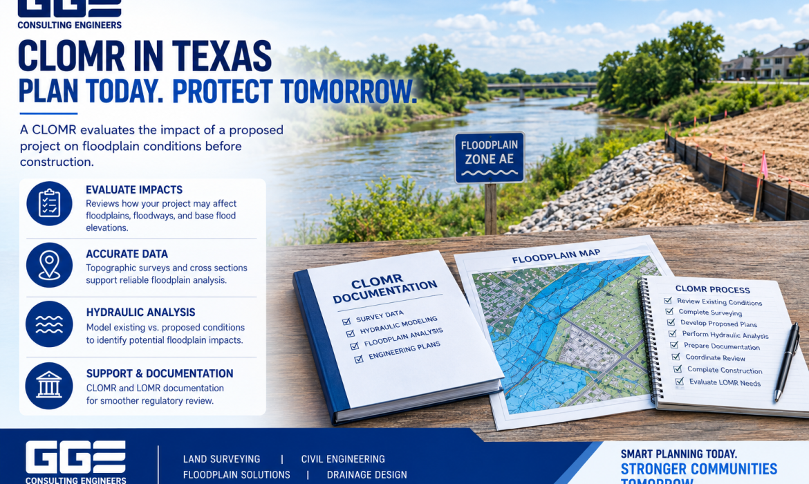
Developing property in or near a mapped floodplain requires careful planning. Flood zones, base flood elevations, drainage patterns, proposed grading, and site improvements can all affect how a project moves forward.
One important FEMA process developers may encounter is a Conditional Letter of Map Revision, commonly known as a CLOMR. A CLOMR evaluates the expected impact of a proposed project on existing floodplain conditions before construction is completed.
Understanding clomr in Texas requirements can help property owners, developers, and contractors determine when floodplain analysis, surveying, hydraulic modeling, and engineering documentation may be necessary.
GGE Consulting Engineers provides civil engineering and land surveying services that support floodplain-related development projects in Texas. Understanding the purpose of a CLOMR can help project teams identify potential floodplain challenges early.
What Is a CLOMR?
A Conditional Letter of Map Revision, or CLOMR, is a FEMA review of a proposed project that may affect the floodplain conditions shown on an effective Flood Insurance Rate Map.
A CLOMR in Texas generally evaluates whether a proposed project, if constructed according to the submitted plans and supporting technical information, would result in changes to the effective floodplain, floodway, or base flood elevations.
The term “conditional” is important because the review concerns a proposed project rather than final post-construction conditions.
A CLOMR may become relevant when proposed grading, filling, structures, drainage improvements, channel modifications, or other development activities could affect mapped floodplain conditions.
Why Does a CLOMR Matter in Texas?
Floodplain conditions are an important consideration for property development because changes to a site can affect how stormwater and floodwater move through the area.
For example, placing fill within a floodplain may alter available flood storage or flow characteristics. Changes to channels, road crossings, drainage structures, or site grading may also affect water surface elevations.
A CLOMR provides a formal evaluation of anticipated project impacts before construction.
For Texas developers, early floodplain evaluation can help identify whether proposed improvements may require additional engineering analysis or regulatory coordination.
Projects that may involve floodplain considerations include:
- Commercial developments
- Residential subdivisions
- Roadway improvements
- Drainage projects
- Channel modifications
- New structures
- Site grading and fill
- Utility and infrastructure improvements
The actual requirements depend on the project’s location, design, floodplain conditions, and applicable regulations.
When Is a CLOMR Required in Texas?
There is no single requirement that applies to every Texas property. The need for a CLOMR depends on the proposed improvements and their potential effect on the effective floodplain mapping.
A CLOMR may be appropriate when a proposed project could result in changes to floodplain boundaries, floodway conditions, or base flood elevations.
Before determining whether a CLOMR is needed, the project team should review the property’s mapped flood zone, existing topography, floodway status, proposed grading, drainage conditions, and anticipated development.
Local floodplain requirements should also be considered because requirements can vary by jurisdiction.
This is why floodplain evaluation should begin during project planning rather than after construction documents are already complete.
CLOMR vs. LOMR: What Is the Difference?
CLOMR and LOMR are related FEMA processes, but they apply at different stages of a project.
A CLOMR evaluates anticipated conditions associated with a proposed project before construction. A LOMR, or Letter of Map Revision, addresses qualifying changes based on final conditions after an approved project has been constructed.
|
Feature |
CLOMR |
LOMR |
|
Timing |
Before construction |
After construction |
|
Purpose |
Evaluates proposed conditions |
Documents qualifying final changes |
|
Information |
Proposed plans and analysis |
Final project information |
|
Floodplain impact |
Anticipated |
Existing post-construction condition |
|
Outcome |
Conditional determination |
Final map revision |
Understanding LOMR in Texas requirements alongside CLOMR procedures helps developers determine which floodplain process may apply to their project.
The appropriate approach should always be based on the actual project conditions and applicable requirements.
What Information Is Needed for a CLOMR?
A CLOMR requires technical information that allows proposed floodplain impacts to be evaluated.
The exact documentation varies by project, but supporting information may include survey data, engineering plans, topographic information, hydraulic modeling, grading plans, drainage information, and other technical documentation.
Important information can include:
- Existing and proposed topography
- Site and property boundaries
- Drainage features
- Proposed grading
- Structures
- Channels and crossings
- Hydraulic model information
- Cross sections
- Base flood elevations
Accurate survey information is particularly important because hydraulic modeling depends on reliable site geometry and elevation data.
GGE Consulting Engineers’ Land Surveying services can support floodplain projects by providing topographic and field information needed for engineering analysis.
The Role of Floodplain Surveying
Surveying is an important part of floodplain analysis. Engineers need accurate information about existing ground elevations, drainage features, channels, structures, and other physical characteristics of the site.
A floodplain survey may include detailed topographic information and cross sections that can be incorporated into hydraulic analysis.
Depending on the project, survey information may document:
- Existing ground elevations
- Channels
- Bridges and culverts
- Drainage structures
- Existing improvements
- Floodplain features
- Elevation control
The survey data provides the physical foundation for the engineering analysis. Inaccurate or incomplete field information can affect the reliability of the resulting hydraulic evaluation.
For projects requiring broader site analysis, GGE Consulting Engineers’ Civil Engineering services can coordinate surveying, drainage design, grading, and floodplain analysis.
How Hydraulic Modeling Supports a CLOMR
Hydraulic modeling helps engineers evaluate how water is expected to move through a floodplain or drainage system.
For a CLOMR project, engineers may compare existing conditions with proposed conditions to determine whether the planned development could change water surface elevations or floodplain characteristics.
The analysis may evaluate:
- Existing site conditions
- Proposed development conditions
- Changes in water surface elevations
- Floodplain impacts
- Floodway impacts
- Potential mitigation measures
GGE Consulting Engineers uses hydraulic analysis, including HEC-RAS modeling, as part of its floodplain engineering work.
Survey data, proposed grading, drainage design, and hydraulic modeling must work together to accurately evaluate the potential effects of development.
CLOMR and Local Floodplain Requirements
A FEMA review is not necessarily the only floodplain-related requirement for a Texas development project.
Local jurisdictions may have additional floodplain management requirements involving grading, drainage, floodway development, finished floor elevations, fill, compensatory storage, permits, or other project conditions.
The applicable requirements can vary depending on the city, county, watershed, and project location.
Project teams should identify the responsible local floodplain authority early and understand which requirements apply to the proposed development.
A CLOMR review should therefore be considered part of the broader floodplain planning process rather than an isolated engineering task.
General CLOMR Process
Although individual projects vary, the process generally follows several stages.
1. Review Existing Conditions
The project team evaluates the effective floodplain mapping, flood zone, floodway, topography, and existing drainage conditions.
2. Complete Surveying
Surveyors collect the topographic and cross-section information required for engineering and hydraulic analysis.
3. Develop Proposed Plans
Civil engineers prepare proposed grading, drainage, structures, channels, roads, or other improvements.
4. Perform Hydraulic Analysis
Existing and proposed conditions are analyzed to evaluate potential floodplain impacts.
5. Prepare Documentation
The required survey information, engineering plans, hydraulic analysis, and supporting documentation are compiled for review.
6. Coordinate Review
The project team addresses applicable technical comments and coordinates with the appropriate reviewing authorities.
7. Complete Construction
If the project proceeds, construction should follow the plans and conditions evaluated during the CLOMR process.
8. Evaluate LOMR Requirements
After construction, a LOMR may be appropriate when final project conditions support a permanent revision to effective floodplain mapping.
Why Early CLOMR Evaluation Matters
Floodplain issues discovered late can affect site layout, grading, drainage design, structures, and construction planning.
Early evaluation gives developers a better understanding of potential floodplain constraints before significant design work is completed.
Project teams should consider:
- Current floodplain mapping
- Existing site elevations
- Floodway conditions
- Proposed grading
- Drainage patterns
- Potential elevation changes
- Local floodplain requirements
- Required surveying and hydraulic analysis
GGE Consulting Engineers’ Pre-Project Consulting services can also support early project evaluation by identifying engineering and development considerations before construction begins.
How GGE Consulting Engineers Supports Floodplain Projects
CLOMR and LOMR projects can require coordination between surveying, civil engineering, hydraulic analysis, grading, drainage, and regulatory documentation.
GGE Consulting Engineers provides integrated engineering and surveying support for applicable floodplain and development projects.
Services may include:
- Floodplain surveys
- Topographic surveys
- Cross-section surveys
- Hydraulic modeling
- Floodplain analysis
- CLOMR documentation
- LOMR documentation
- Elevation Certificates
- Drainage engineering
- Site development engineering
Combining surveying and civil engineering within the same project workflow can help maintain consistency between field information, engineering analysis, and proposed site improvements.
Conclusion
Understanding clomr texas requirements is an important part of planning development in or near mapped floodplain areas. A CLOMR evaluates anticipated floodplain impacts before construction, while a LOMR addresses qualifying final changes after construction.
Accurate surveying, grading information, hydraulic modeling, drainage design, and regulatory coordination are important components of the process. Addressing these issues early can help developers identify potential constraints and make informed decisions during project planning.
GGE Consulting Engineers combines land surveying and civil engineering capabilities to support floodplain analysis, hydraulic modeling, drainage design, and CLOMR and LOMR documentation. Contact us to discuss your Texas floodplain development project and determine what surveying and engineering support may be appropriate.
Frequently Asked Questions
What is a CLOMR in Texas?
A CLOMR is a Conditional Letter of Map Revision that evaluates the expected floodplain effects of a proposed project before construction.
When is a CLOMR required in Texas?
A CLOMR may be needed when proposed development could affect FEMA-mapped floodplain conditions, floodways, or base flood elevations.
What is the difference between CLOMR and LOMR?
A CLOMR evaluates proposed conditions before construction. A LOMR addresses qualifying final changes after construction.
Does every floodplain project need a CLOMR?
No. The need depends on the proposed improvements, floodplain conditions, hydraulic impacts, and applicable requirements.
What survey is needed for a CLOMR?
A CLOMR may require detailed topographic and cross-section survey information suitable for hydraulic modeling and floodplain analysis.
Can grading affect CLOMR requirements?
Yes. Grading, fill, excavation, or other site changes can affect floodwater movement and may require additional floodplain evaluation.
How does hydraulic modeling help a CLOMR?
Hydraulic modeling compares existing and proposed conditions to evaluate potential changes in water surface elevations and floodplain characteristics.
Can GGE Consulting Engineers support CLOMR projects?
Yes. GGE Consulting Engineers provides surveying, civil engineering, hydraulic analysis, and CLOMR and LOMR documentation for applicable projects.