
Land development and site development are not the same thing, though they’re used interchangeably so often that even experienced developers and property owners blur the line. Land development is the broader upstream process of converting raw, undivided land into entitled, platted parcels ready for future construction. Site development is the precise, infrastructure-focused civil engineering work that transforms a specific entitled parcel into a construction-ready site with a valid building permit.
Understanding which phase your project is in and which type of land development engineering it actually requires determines your timeline, your regulatory pathway, your engineering scope, and ultimately, your budget. Misidentifying the phase early costs far more than proper engineering ever would, and it’s the first thing GGE Consulting Engineers checks before any project scope is defined.
Quick Answer: What Is the Difference Between Land Development and Site Development?
| Land Development | Site Development | |
| Definition | Converting raw land into entitled, platted parcels | Preparing a specific parcel for a building permit and construction |
| Phase | Upstream / first | Downstream / second |
| Scope | Entire tract or subdivision | Single parcel or project site |
| Primary Output | Approved plats, master utility plans, entitlements | PE-sealed civil drawings, grading plans, permit approval |
| Typical Timeline | 12–36 months | 2–6 months |
| Key Agencies (Texas) | FEMA, TxDOT, TCEQ, county, city planning | City Development Services, SAWS, CPS Energy, building department |
Land development always precedes site development. You cannot do site development on land that has not been entitled and platted, which is why understanding the sequence is as important as understanding the definitions.
What Is Land Development?
Land development is the process of converting raw or underutilized land into a legal, physical, and regulatory state where individual parcels can be built upon. It is the upstream work that establishes the infrastructure framework, legal boundaries, and regulatory approvals that all subsequent construction depends on.
Land development includes:
- Rezoning and entitlement: Changing the legal use classification of a property so it is permitted for residential, commercial, or mixed-use construction
- Subdivision platting and lot layout: Creating the legally recorded map that defines individual lot lines, easements, setbacks, and public dedications
- Master drainage and floodplain planning: Designing the stormwater infrastructure for an entire tract and identifying FEMA Special Flood Hazard Area (SFHA) conflicts that must be resolved before development
- Major utility corridor planning: Sizing and routing water distribution, sanitary sewer collection, and roadway systems to serve the entire subdivision
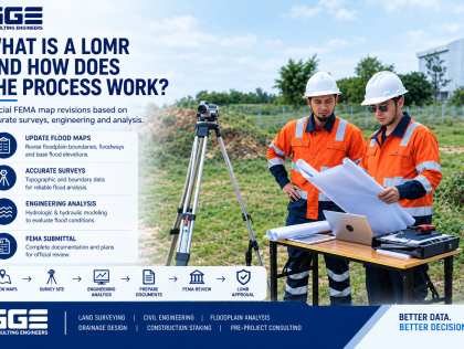
- FEMA floodplain analysis: Filing Conditional Letters of Map Revision (CLOMRs) and Letters of Map Revision (LOMRs) to reclassify flood zones and unlock buildable acreage
- Regulatory approvals: Coordinating with TCEQ, TxDOT, FEMA, county floodplain administrators, and municipal planning departments to obtain all required permits and approvals
The output of land development is not a building. It is a set of platted lots, approved infrastructure designs, and recorded regulatory documents that make site development legally possible.
What Is Site Development?
Site development is the civil engineering process of transforming a specific, already-entitled parcel into a construction-ready site. It begins after a parcel has been platted and approved, and it ends when a building permit is issued and a contractor can break ground.
Site development includes:
- Site grading and earthwork: Establishing finished floor elevations, managing cut-and-fill, and directing stormwater away from structures
- Stormwater drainage design: Calculating runoff from design storms, sizing detention ponds or underground storage, and designing compliant outfall systems
- Utility connections: Designing water service, sanitary sewer laterals, and electrical connections to the mains established in the land development phase
- Access and parking layout: Designing drive aisles, parking stalls, fire lanes, and ADA-compliant pedestrian paths
- PE-sealed construction documents: Producing fully dimensioned, technically specified civil drawings sealed by a licensed Professional Engineer for permit submission
- Multi-agency permit coordination: Managing submission and review cycles across the building department, water utility, and other reviewing agencies until full permit approval is issued
- Construction-phase oversight: Reviewing contractor submittals, responding to RFIs, conducting site observations, and preparing as-built documentation
The output of site development is a complete set of permitted civil drawings that a general contractor can build from. It is the final technical step before vertical construction begins.
Land Development vs Site Development: The Full Comparison
When comparing Land Development vs Site Development, most articles stop at saying that land development is simply “bigger.” The real differences are much more specific and they directly affect who you hire, which regulatory agencies are involved, and how long your project takes.
| Category | Land Development | Site Development |
| Scope | Entire tract or multi-lot subdivision | Single parcel or building site |
| Primary Goal | Create entitled, platted, buildable lots | Prepare a specific lot for a construction permit |
| Key Deliverables | Plats, master utility plans, rezoning approvals, CLOMR/LOMR | Grading plans, drainage design, utility connections, PE-sealed permit drawings |
| Regulatory Focus | FEMA, TxDOT, TCEQ, city planning, county commissioners | City Development Services, SAWS, CPS Energy, building department |
| Timeline | 12–36 months | 2–6 months |
| Engineering Disciplines | Civil engineering, land surveying, environmental | Civil engineering, structural (foundation coordination) |
| Software Tools | HEC-HMS, HEC-RAS, AutoCAD Civil 3D, GIS | HEC-HMS, HEC-RAS, AutoCAD Civil 3D, Flowmaster |
| End Result | Entitled, platted land ready for site development | Permitted, construction-ready site |
| Cost Driver | Regulatory complexity, FEMA floodplain issues, number of lots | Site topography, utility distances, drainage detention requirements |
The most common mistake developers make is assuming a firm that handles one phase automatically handles both at the same level. Land development engineering requires deep regulatory fluency in platting, floodplain reclassification, and master infrastructure planning. Site development engineering requires precision civil design, construction document production, and multi-agency permit management. The skill sets overlap but are not identical.
How Land Development and Site Development Sequence Together
Think of them as two sequential chapters in the same project, not two separate projects.
Phase 1: Land Development in Practice
A developer acquires 40 acres of raw land outside a growing Texas city. The land is partially within a FEMA-designated Special Flood Hazard Area (SFHA). Before a single lot can be sold or a building permit issued, the land development engineering team must:
- Conduct a boundary and topographic survey of the entire 40-acre tract
- Perform hydrologic analysis using HEC-HMS to model watershed runoff under design storm conditions
- Perform hydraulic analysis using HEC-RAS to model floodplain water surface elevations and determine which portions of the tract are truly outside the 100-year flood zone
- Prepare and file a CLOMR application with FEMA to reclassify floodplain boundaries and identify buildable acreage
- Design the subdivision street layout, water distribution system, and sanitary sewer collection system to serve all planned lots
- Prepare preliminary and final plat documents for municipal and county approval
- Coordinate TxDOT access permits for driveways and roadway connections to the state highway system
Realistic timeline for this phase: 12 to 24 months, depending on FEMA review timelines, municipal planning board schedules, and project complexity.
Phase 2: Site Development in Practice
A commercial buyer contracts one of the now-entitled lots for a retail center. The site development engineer takes over:
- Develops a grading plan specific to that parcel’s topography and drainage constraints
- Designs parking layout, drive aisles, fire lanes, and ADA-compliant pedestrian infrastructure
- Designs the connection from the building to the water and sewer mains established in the land development phase
- Designs the on-site stormwater detention system to meet City of San Antonio drainage criteria
- Produces fully PE-sealed civil drawings in AutoCAD Civil 3D for permit submission to City Development Services, SAWS, and CPS Energy
- Manages multi-agency review, responds to comments, and resubmits until full permit approval is obtained
Realistic timeline for this phase: 2 to 5 months for a commercial site, depending on the reviewing jurisdiction’s workload and whether any unforeseen site conditions arise.
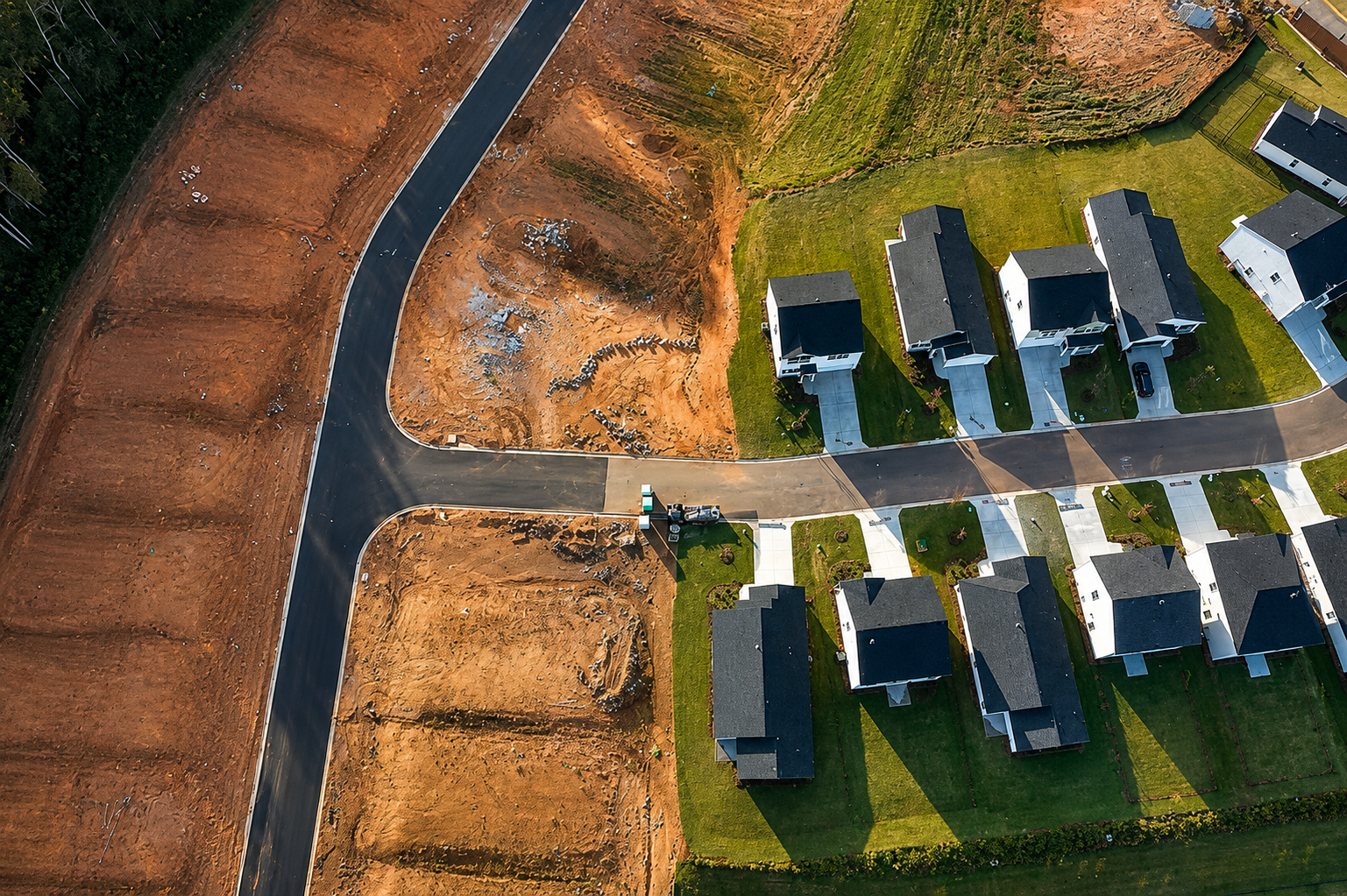
Neither phase is optional. And critically, the quality of the land development work in Phase 1 directly determines how smooth the site development phase will be. Poorly designed master drainage, incorrectly sized utility mains, or unresolved floodplain issues in Phase 1 become expensive surprises in Phase 2.
What Land Development Engineering Actually Involves
Land development engineering is more regulated and technically demanding than most people outside the civil engineering industry realize. In Texas especially, it is not simply drawing a lot of lines on a map.
Subdivision Design and Platting
A subdivision plat is a legal instrument. It establishes lot boundaries, drainage and utility easements, building setbacks, public right-of-way dedications, and access restrictions that permanently attach to the property record. Errors in a plat create title defects, construction conflicts, and regulatory disputes that take years and significant legal cost to resolve. Civil engineers working in land development must have working knowledge of the Texas Local Government Code subdivision requirements, municipal subdivision ordinances, and the plat approval process at both city and county levels.
FEMA Floodplain Analysis: CLOMR and LOMR
Floodplain engineering is one of the highest-value services in Texas land development. FEMA-mapped Special Flood Hazard Areas cover millions of acres of otherwise developable land across the state. A rigorous CLOMR analysis using HEC-RAS for hydraulic modeling and HEC-HMS for hydrologic analysis can identify buildable acreage that was previously assumed to be undevelopable, unlocking project value that would otherwise be permanently lost.
A CLOMR (Conditional Letter of Map Revision) tells FEMA: “If we build this project as designed, the flood map should change.” FEMA reviews the technical analysis and, if approved, issues a conditional determination confirming the map revision is warranted. After construction is completed, a LOMR (Letter of Map Revision) formally updates the official Flood Insurance Rate Map (FIRM) to reflect post-construction conditions. Properties successfully removed from the SFHA are no longer subject to mandatory flood insurance requirements a significant economic benefit to future lot buyers.
Master Infrastructure Planning
A subdivision of 200 lots requires a water distribution system sized for peak domestic and fire flow demand, a sanitary sewer collection system with appropriate capacity and lift station design if terrain requires, and a street network designed and constructed to municipal standards for future public dedication. These systems must be coordinated and sized correctly before a single lot is sold. Getting master infrastructure wrong is not a fixable problem at the site development stage it is a capital-intensive retrofit.
What Site Development Engineering Actually Involves
Site development is where the physical transformation of a specific parcel happens. The engineering is precise, permit-driven, and tightly coordinated with local reviewing agencies.
Grading and Earthwork Plans
A grading plan is the foundation of everything else on a development site. It establishes finished floor elevations for buildings, directs stormwater runoff to designed collection points, defines cut-and-fill earthwork volumes that contractors bid on, and ensures ADA accessibility across parking and pedestrian areas. Poor grading design causes ponding, foundation settlement, and pavement failure problems that typically appear years after construction and cost multiples of what correcting the grading plan upfront would have.
Stormwater Drainage Design
Most Texas municipalities require development projects to manage stormwater on-site detaining runoff and releasing it at pre-development rates before discharging to the public drainage system. That means calculating runoff from the design storm (typically the 25-year or 100-year event), sizing detention ponds or underground storage systems, and designing outlet structures that comply with municipal drainage criteria.
Utility Connections
Connecting a new building to existing water and sewer infrastructure requires coordinated design and approval from multiple utility providers. In San Antonio, that means SAWS (San Antonio Water System) for water service and sanitary sewer, CPS Energy for electrical service, and City Development Services for civil permit review. Each agency has distinct submittal requirements, plan review timelines, and inspection protocols. A site development engineer who has not built working relationships with these agencies will face avoidable delays.
PE-Sealed Construction Documents
Every civil drawing submitted for a building permit in Texas must bear the seal and signature of a licensed Professional Engineer registered with the Texas Board of Professional Engineers and Land Surveyors (TBPELS). The PE’s seal is not a formality it is a legal certification of technical accuracy that protects building owners, construction lenders, and the public from substandard design. An unsealed or improperly sealed plan set will be rejected at permit intake without review.
The Three Things Most Developers Get Wrong About These Two Phases
1. Treating them as interchangeable scopes
Asking a site development firm to manage your subdivision master planning or asking a land planner to handle your commercial site permit often produces gaps in technical execution and agency relationships. The regulatory knowledge, software tools, engineering judgment, and agency familiarity required are genuinely different at each phase. The best outcomes come from a firm with verified, principal-level experience in both.
2. Underestimating land development timelines
Platting, FEMA floodplain reclassification, and TxDOT access permits operate on agency review timelines that developers cannot compress. A realistic land development schedule builds in 60-to-90-day city plan review cycles, potential resubmittals, FEMA’s own multi-month CLOMR review process, and county commissioners court plat approval schedules. Projects that budget a 90-day land development phase routinely find themselves 12 to 18 months in before the first site permit becomes possible.
3. Skipping pre-project due diligence
Before committing to a land acquisition or signing a site development contract, experienced developers commission a feasibility assessment that identifies floodplain encumbrances, utility capacity limitations, zoning conflicts, and access permit requirements. Discovering a FEMA floodplain problem after closing on raw land is expensive. Discovering it during due diligence is actionable information that changes your offer price, your project layout, or your decision to acquire at all.
Realistic Project Timelines: What to Expect at Each Phase
Success in land development and site development is not defined by a single number. It depends on project type, regulatory complexity, site conditions, and agency workloads. These benchmarks reflect realistic South Texas experience.
| Project Type | Land Development Timeline | Site Development Timeline |
| Commercial site, already platted | Not applicable | 2–4 months |
| Commercial site near FEMA floodplain | 8–18 months (with CLOMR process) | 3–6 months after CLOMR approval |
| Residential subdivision (50–200 lots) | 12–24 months | 2–5 months per construction phase |
| Mixed-use development | 18–36 months | 3–6 months per building site |
| Public infrastructure (roads, drainage) | 6–18 months | Concurrent with construction |
Developers who reach their milestones on schedule are the ones who staffed experienced land development engineering at the very start of a project, not the ones who tried to compress the front end and recover the time during construction. Front-end compression in land development almost always becomes back-end cost overruns in construction.
Why an Integrated Engineering Firm Outperforms Separate Firms at Each Phase
The most avoidable source of project delay and cost overrun in Texas development is inter-firm coordination failure.
When land development, site development, structural engineering, and land surveying are contracted to separate firms, predictable problems emerge: survey data formatted by one firm that requires costly re-processing before the civil engineer can use it; structural foundation designs that don’t account for civil grading constraints; permit packages with inconsistent coordinate systems, elevation benchmarks, or sheet numbering across disciplines; RFI responses that bounce between firms for weeks before reaching the contractor.
At GGE Consulting Engineers, the civil engineering team managing your site development grading is the same team coordinating with the in-house survey crew and the structural engineer designing your building foundation. Survey data moves directly into civil design on the day it is collected. Civil grading constraints inform structural foundation design in the same workflow. Permit packages are internally cross-checked before submission to any reviewing agency.
The Bottom Line: Land Development vs Site Development
Land development and site development are sequential, complementary phases of the same project lifecycle not competing alternatives. Land development is the upstream regulatory and infrastructure work: entitlement, subdivision platting, master utility design, FEMA floodplain analysis, and the multi-agency approvals that make individual parcels legally buildable. It takes months to years and requires civil engineers with deep regulatory relationships and floodplain expertise.
Site development is the downstream civil engineering execution: grading plans, stormwater drainage, utility connections, permit drawings, and construction-phase oversight for a specific parcel. It takes weeks to months and requires precision civil design, permit management, and close coordination with local reviewing agencies.
Developers who move from raw land to ribbon-cutting on schedule are the ones who understood these two phases clearly, engaged the right engineering expertise for each, and did not try to compress either timeline beyond what the regulatory process actually allows. If you’re ready to move your project forward with confidence, contact us today — we’ll help you identify exactly where your project stands and what it needs next.
Frequently Asked Questions
What is the difference between land development and site development?
Land development prepares raw land for future construction through platting, utilities, and regulatory approvals; site development takes one entitled parcel and engineers it to a building permit.
Do I need both for a commercial project in Texas?
If your parcel is already platted, you need site development only; if you’re starting with raw or unplatted acreage, land development engineering comes first.
What does land development engineering include?
It covers subdivision platting, rezoning, master water and sewer design, FEMA floodplain analysis (CLOMR/LOMR), HEC-HMS/HEC-RAS modeling, TxDOT access permitting, and multi-agency regulatory coordination.
How long does site development take in San Antonio?
Most commercial sites take two to five months from engineering through permit approval; sites near a FEMA flood zone require CLOMR processing first, adding eight to eighteen months.
What is a CLOMR and when is it required?
A CLOMR is a FEMA determination that a proposed project would justify revising the official Flood Insurance Rate Map; it’s required when development proposes to fill or build within a Special Flood Hazard Area.
Can one firm handle both land development and site development?
Yes — an integrated firm with shared survey data, drawing standards, and PE oversight across both phases eliminates the coordination failures that cause most permit delays and cost overruns.