

OFFICE HOURS
Contact us:
- Mon–Fri: 08:00–17:00
OUR BROCHURES
Land Surveying

Service overview
GGE Consulting Engineers delivers full-service licensed land surveying throughout San Antonio, Bexar County, Hays County, and South Texas. Every survey is performed using sub-centimeter GPS/GNSS technology, robotic total stations, and Texas VRS network connectivity, and is sealed by a Texas Registered Professional Land Surveyor with 35+ years of continuous practice. GGE’s integrated model means survey data flows directly into civil engineering design — eliminating the delays and errors that occur when separate firms handle each discipline.

THE details
All our services are driven by three core values: Integrity, accountability and reliability. Our Land Surveying Services are amongst the best in the industry across the Austin-San Antonio metroplex and South Texas.
Precision Measurement. Legally Defensible Boundaries.
Boundary Survey
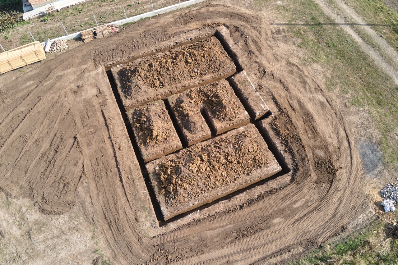
Establishes and documents the legal property lines of a parcel — locating and setting monuments at corners, measuring all boundary lines, reconciling field evidence with recorded deeds and adjacent plats, identifying encroachments and easements, and producing an RPLS-sealed plat suitable for recording at the county clerk`s office. The foundational survey required for any real estate transaction, permit application, or boundary dispute resolution in Texas.
Topographic Survey
Maps the physical surface of the land in three dimensions — terrain contours and elevations, drainage patterns, existing structures and improvements, above-ground utilities, trees and vegetation, and paved surfaces — creating the accurate existing conditions base map required before any civil engineering design, drainage study, grading plan, or architectural site plan can be prepared. Delivered in AutoCAD and compatible with Civil 3D digital terrain modeling.
Right-of-Way (ROW) Survey
Defines and documents the limits of public and private rights-of-way for roadways, utilities, and drainage corridors — meeting the TxDOT ROW Survey Manual, City of San Antonio standards, and county ROW requirements. Includes ROW monument location, encroachment identification, legal descriptions for ROW acquisition, and coordination with TxDOT and local government review. GGE delivered TxDOT-compliant ROW surveys on the $1.9M Toyota Plant Access Improvements project for the City of San Antonio.
ALTA/NSPS Land Title Survey
The most comprehensive commercial survey standard available — combining boundary survey, improvement mapping, easement identification, access documentation, and lender/title company disclosures into a single RPLS-sealed document that satisfies the Minimum Standard Detail Requirements of the American Land Title Association and National Society of Professional Surveyors. Required by lenders and title companies for commercial property purchases, refinancing, and development financing. GGE performed an ALTA/NSPS survey for the Abbas Subdivision commercial development in San Antonio.
GPS/GIS Services
Spatial data collection, mapping, and GIS integration using multi-constellation GPS/GNSS receivers connected to the Texas VRS (Virtual Reference Station) network — providing real-time centimeter-level accuracy without a dedicated base station. GGE collects, processes, and delivers spatial data as shapefiles, geodatabases, or other formats for GIS analysis, asset management, and infrastructure mapping. Compatible with ESRI, AutoCAD, and municipal GIS systems.
Subdivision Platting
Complete surveying support for residential and commercial subdivision platting — parent tract boundary survey, topographic data collection for drainage and grading design, lot layout coordination with civil engineer, preliminary and final plat preparation meeting county subdivision regulations and TBPLS minimum standards, agency review coordination, and final Mylar and digital recording submission at the county clerk. GGE's surveying integrates directly with the civil engineering subdivision design — no inter-firm coordination gap.
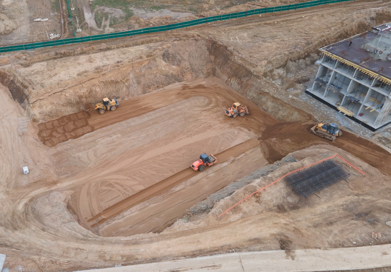
Construction Stacking
Translates approved permit drawings into physical stakes on the ground — setting alignment and grade control for roads, utilities, structures, and other improvements so that contractors can build exactly where the engineer designed. Responsive to contractor schedules, including daily mobilization when construction sequencing requires it. Includes pre-construction meetings with contractors, as-built documentation, progress documentation for payment applications, and final as-built plans sealed by the RPLS.
Floodplain & CLOMR Survey
High-accuracy topographic and cross-section surveys specifically structured for FEMA floodplain analysis — including high-density contour data for HEC-RAS hydraulic modeling, cross-section surveys of channels and floodplain corridors, GPS control establishment for model coordinate integration, and ALTA/NSPS base surveys for CLOMR/LOMR submittals. GGE's survey and civil engineering teams work together on floodplain projects — the same firm collects the data and builds the model, eliminating translation errors that compromise FEMA submissions.
The Process
research & preparation
Every survey begins with the historical record — not the field. GGE's survey team researches all deeds, plats, easements, and prior surveys in the chain of title at the county clerk, appraisal district, and TxDOT records (for ROW projects). We identify existing monuments, conflicts in the record, utility easements, and any legal descriptions that must be reconciled before field work begins. For projects with FEMA or TxDOT involvement, we confirm the governing standards and accuracy requirements before mobilization. This research phase prevents the costly surprises that occur when field crews discover boundary or record conflicts mid-project.
field survey
Field crews mobilize with robotic total stations, multi-constellation GPS/GNSS receivers, digital levels, and rugged field data collectors — collecting all measurements, coordinates, and feature codes required for the survey type. Boundary work includes locating and setting monuments, measuring all boundary lines, and identifying improvements and encroachments. Topographic work captures a systematic grid of terrain points, utility crossings, drainage features, and site improvements. GPS control establishes the coordinate framework that ties all subsequent measurements to a consistent reference system throughout the project.
data processing
Field data is downloaded and processed through a multi-step office workflow — network adjustment to achieve closure within project accuracy requirements, AutoCAD drafting of survey plans to TBPLS and project-specific standards, legal description preparation (metes and bounds) where required, digital terrain model generation for topographic surveys, and three-level internal quality control review. The final internal review is performed by Gustavo Gonzalez, P.E. — confirming completeness, compliance, and professional presentation before the survey leaves GGE's office. For surveys integrating directly into civil design, data transfer to the engineering team occurs at this stage.
Delivery & Agency Coordination
Finalized survey plans are sealed and signed by GGE's RPLS- RLS and delivered to the client in a sealed PDF, AutoCAD DWG, and any other format required by the project or governing agency. For subdivision plats, GGE manages the county planning and development review process — tracking comment responses, coordinating resubmittals, and facilitating final Mylar and digital recording at the county clerk. For ROW projects, GGE coordinates the TxDOT or municipal review and acceptance process. Revisions requested during agency review are typically turned around within 3–5 business days. GGE provides complete documentation for each deliverable, including transmittal letters and a project record for the client's files.
Why Choose GGE land surveying Services?
45-Year RPLS-RLS Legacy
Engineering Integration
Government Standards
Sub-centimeter Precision
Rapid Mobilization
Advanced Technology
frequent QUESTIONS
Land surveying is the professional science of measuring, mapping, and legally defining the spatial characteristics of land — including property boundaries, elevations, improvements, easements, and their relationships to adjacent parcels and public rights-of-way. In Texas, the Texas Professional Land Surveying Practices Act (Chapter 1071, Texas Occupations Code) requires that all of the following be performed by or under the direct supervision of a Texas Registered Professional Land Surveyor (RPLS):
- Boundary surveys determining or retracing property lines
- Subdivision plats dividing land into lots and blocks
- ALTA/NSPS Land Title Surveys for commercial real estate transactions
- Right-of-way surveys for public roads, utilities, and infrastructure
- Any survey work on which a licensed surveyor’s professional seal is placed
Common triggers requiring a licensed survey in Texas include: buying or selling property (especially commercial), applying for a development permit, subdividing land, resolving a boundary dispute, obtaining a construction loan, complying with FEMA floodplain requirements, and acquiring right-of-way for public infrastructure.
GGE’s land surveying is performed by Richard Solis, R.P.L.S. — Texas-licensed since 1987 — with Gustavo Gonzalez, P.E. providing overall project management and quality oversight. Every deliverable is RPLS-sealed and meets TBPLS minimum standards.
These are the two most commonly confused survey types, and they answer entirely different questions about a property.
A boundary survey answers: where exactly do my legal property lines fall? It locates and documents the boundaries of a parcel — finding and setting corner monuments, measuring dimensions, reconciling field evidence with recorded deeds and adjacent surveys, and identifying encroachments and easements. The deliverable is an RPLS-sealed plat and, if needed, a metes-and-bounds legal description. It is required for real estate transactions, permit applications, and boundary disputes. It does not tell you anything about the physical terrain, existing improvements, or elevations on the property.
A topographic survey answers: what does the land physically look like? It captures the three-dimensional shape of the existing terrain — elevations, contour lines, drainage flow directions, existing structures, above-ground utilities, trees, paved surfaces, and other features. It does not establish legal boundaries. It is the required input for civil engineering design: without an accurate topographic survey, a civil engineer cannot design drainage, grading, roadways, or site utilities.
Many development projects require both — the boundary survey establishes the legal limits within which design must stay, and the topographic survey provides the existing conditions data the civil engineer needs to design the project inside those limits.
GGE frequently delivers boundary and topographic surveys together as a combined scope — with both surveys performed at the same time by the same crew, saving mobilization costs and accelerating the schedule compared to sequential separate scopes.
An ALTA/NSPS Land Title Survey is the highest and most comprehensive survey standard in the United States — prepared to the joint Minimum Standard Detail Requirements established by the American Land Title Association and the National Society of Professional Surveyors. Unlike a standard boundary survey, an ALTA/NSPS survey addresses the full range of matters that a title company and lender need to insure a commercial real estate transaction, including:
- All boundary lines and corner monuments with bearings, distances, and closure
- All improvements on the property — buildings, parking, driveways, fencing
- All easements of record, plotted from legal descriptions
- Access points and rights of access to public roads
- Zoning classification, parking ratios, and setbacks (if table A items selected)
- Evidence of utility service locations and above-ground utility features
- Encroachments by or onto the subject property
ALTA/NSPS surveys are typically required by lenders and title companies as a condition of commercial property purchase, refinancing, or construction loan funding. They may also be required for long-term ground leases, portfolio acquisitions, and certain government-funded development projects.
GGE performed an ALTA/NSPS survey for the Abbas Subdivision commercial development — a 10-acre site in a FEMA floodplain — where the ALTA survey was combined with high-density topographic data collection for HEC-RAS hydraulic modeling in a single mobilization.
Construction staking — also called construction layout or setting out — is the process of translating the engineer’s approved design drawings from paper coordinates into physical marks and stakes on the ground. Without construction staking, a contractor does not know the precise location and elevation at which to build each element of the project.
For a typical civil or structural project, construction staking establishes:
- Horizontal alignment — where roads, pipelines, buildings, and other improvements are positioned in plan
- Vertical grade — the elevations at which improvements must be built to match the approved drainage, pavement, and utility design
- Structure locations — building corners, foundation lines, column centerlines, and utility connection points
- Offset stakes — stakes set at a measured offset from the actual construction line so they survive earth-moving operations
In Texas, construction staking for permitted improvements must be performed by or under the supervision of a licensed RPLS. This is not merely a regulatory requirement — it is a practical necessity for quality assurance, since imprecise staking is a leading cause of construction defects, permit non-conformance, and costly rework discovered during inspections.
GGE’s construction staking is coordinated directly with our civil and structural engineering team — when we designed the project, our surveyors stake from the same coordinate files used to produce the permit drawings, eliminating the translation errors that occur when a separate survey firm interprets someone else’s design data.
GGE is the only firm in the San Antonio market that delivers land surveying, civil engineering, and structural engineering under a single project manager, a single contract, and a single invoice. The practical advantages of this model are significant and compound at every stage of a development project:
- Survey field data flows directly into the civil engineer’s AutoCAD Civil 3D design file — in the same coordinate system, without a format conversion or transmittal cycle between firms
- Topographic data collected by the surveyor is immediately available for drainage design, grading, and site development — often the same week as field collection
- Structural foundation design is coordinated with civil grading and site utility plans within the same project team — preventing the conflicts that arise when structural and civil drawings are prepared independently
- Construction staking is performed from the same design coordinate files used by the civil engineer — eliminating the interpretation errors that occur when a separate survey firm works from a different firm’s drawings
- As-built documentation at project closeout is consistent across all disciplines, produced in the same coordinate system as the original survey and design
For clients pursuing publicly funded projects, GGE’s HUB certification as prime contractor provides direct diversity credit on every contract — including the surveying scope — without the administrative burden of managing a separate certified subconsultant invoice and reporting relationship.
On GGE’s ROC USA Manufactured Home Community project — a 54-unit bond-funded infrastructure renovation — the surveying team provided comprehensive topographic and boundary surveys, as-built documentation, and construction control that flowed seamlessly into the civil engineering design, all under one $88,000 GGE contract delivered on schedule and within budget.
Our Featured projects